First Alert Weather: November comes to an end with gusty winds
[anvplayer video=”5150521″ station=”998131″]
ROCHESTER, N.Y. The passage of a fast-moving strong cold front was very evident today.
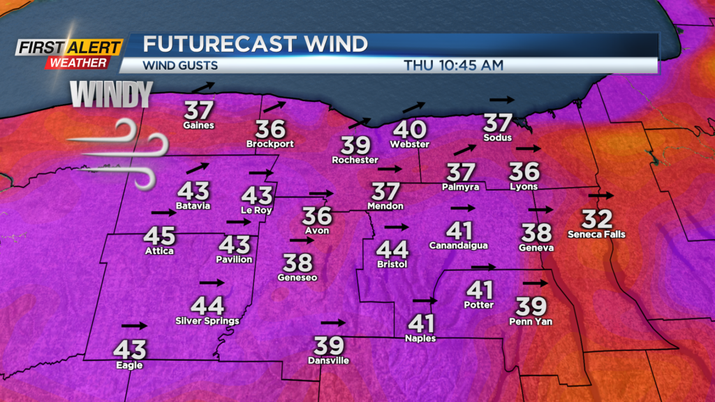
Gusty winds continue to impact the area with sharply colder temperatures arriving in Rochester. As high pressure pushes across the eastern half of the country, the winds will slowly diminish Thursday afternoon.
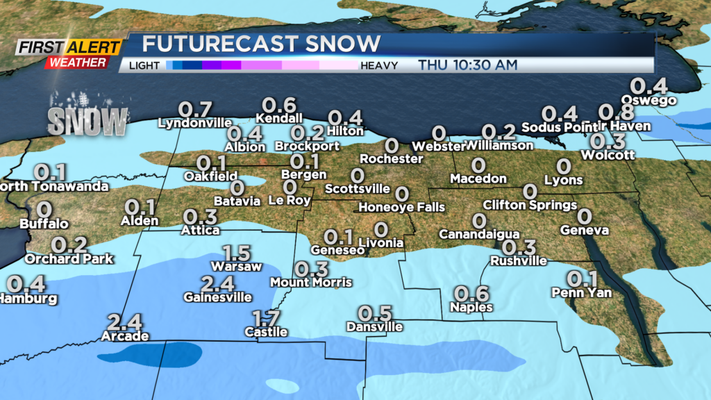
Tonight expect the gusty winds to continue with speeds pushing 20 to 45 miles per hour. There could be a passing flurry in Rochester, but most of the Lake Erie snow showers will be southwest of Rochester where Wyoming County could see 1 to 3 inches, especially in the higher elevations.
Most other communities will see little or no accumulation. The temperature will fall into the upper 20s. Thursday will bring another gusty day, but the winds will diminish later in the afternoon. Most of the area should see clouds giving way to a few more breaks of sunshine by the afternoon. The high temperature will only be in the upper 30s.
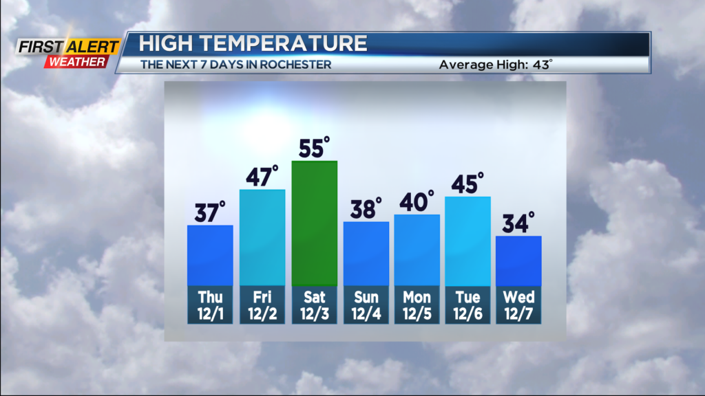
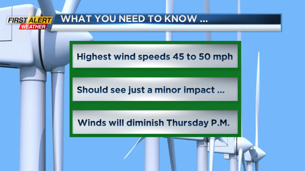
Friday will bring a calmer day with a mix of clouds and sunshine. The high temperature is in the upper 40s. Saturday you can expect a few rain showers and the temperature will climb into the middle 50s. However, strong winds will become a factor again with speeds possibly nearing 60 miles per hour.
At this time, the News10NBC First Alert meteorologists have not issued a yellow alert, but this could change in the coming days due to the potential of strong winds.
First Alert Meteorologist Glenn Johnson has your Wednesday forecast.
Stay tuned to News10NBC First Alert weather for updates on the forecast.