First Alert Forecast: Uneventful Weather, Until The End Of The Week
[anvplayer video=”5156316″ station=”998131″]
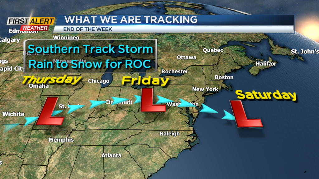
ROCHESTER, N.Y. – Once again, the Rochester area had very little, if any, winter weather this weekend. And the calm conditions will likely continue through the middle of the week. A rather weak cold front will pass over the eastern Great Lakes Monday evening. This will continue a northerly wind flow, which will keep chilly temperatures locked in across Western New York. However, much colder air will begin to move across the upper mid-west with a low pressure system advancing across the Tennessee Valley on Thursday. The two elements will combine to bring a variety of precipitation for Western New York by the end of the week.
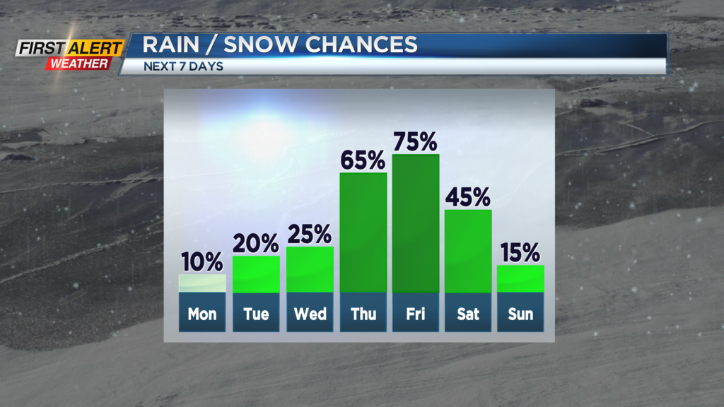
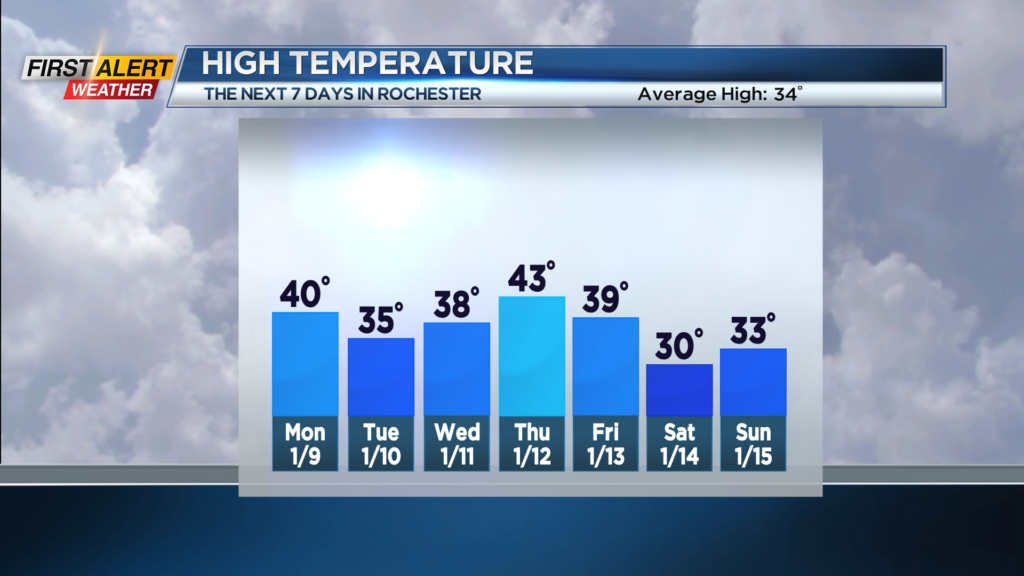
Tonight look for skies to become cloudy with the low temperature in the upper 20s. Monday should be dry again with morning clouds giving way to breaks of sunshine by the afternoon. It will turn breezy with the high temperature near 40 degrees. Tuesday will bring mainly gray skies with the temperature falling into the middle 30s. Wednesday will again feature mostly cloudy skies. It should be dry most of the day, but a mix of rain and wet snow showers will arrive by Wednesday evening. The temperature in the upper 30s.
As the abovementioned low pressure system approaches Western New York on Thursday, a scattered mix of rain and wet snow showers will change to all rain. The temperature will eventually rise into the lower 40s. The rain showers will continue into Thursday night and the temperature will hold steady near 40 degrees. As the storm moves east of Rochester on Friday, colder air will arrive with any rain changing back to snow. At this time, it appears any accumulation into early Saturday will be small, with just a few inches of accumulation possible.
Stay tuned to News 10NBC First Alert weather for any updates on the forecast.