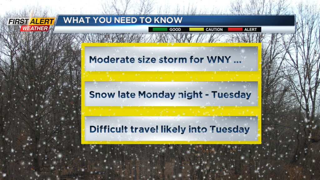
First Alert Forecast: Yellow alert for Tuesday and Tuesday night
[anvplayer video=”5167126″ station=”998131″]
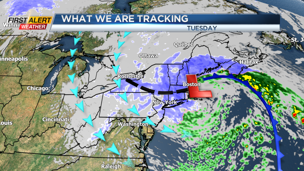
ROCHESTER, N.Y. – There is growing confidence that a moderate size winter storm will have an impact on Western New York. This is a complex set of storms that will combine for just one coastal low-pressure system, commonly known as a nor’easter. This will be a slow-moving storm that will strengthen significantly off the coast of the Massachusetts on Tuesday. Even though this storm will be more than 400 miles away, the area of snow will expand into the Rochester area and the Finger Lakes. The combination of this area-wide snowfall and lake enhanced snow will produce very difficult travel conditions through Tuesday into Tuesday night. It is recommended that you prepare to alter your plans as we get closer to Tuesday. As a result, the News 10NBC First Alert meteorologists continue a yellow alert for Tuesday and Tuesday night.
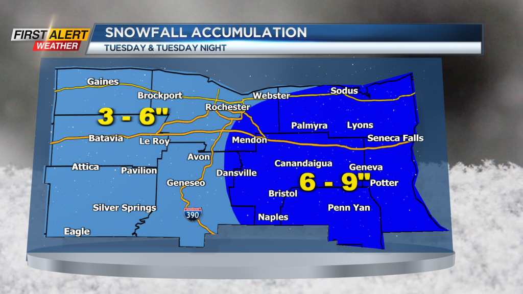
Sunday night will bring passing flurries or a snow shower. Some spots may see a coating of snow overnight with the low temperature near 32 degrees. Monday will be gray for the morning, then a few rain and wet snow showers developing for the afternoon. The high temperature will be in the upper 30s. Monday night will continue occasional snow showers, mainly east of Rochester with one to two inches of accumulation possible. The low near 29 degrees. Tuesday steady snow is likely to begin for the early morning for all of Western New York. That snow will likely be heavy at times later in the afternoon. By the end of the day there will be three to six inches west of the Genesee Valley, with six to nine inches possible to the east (including the Finger Lakes). The snow will begin to taper down as we head into Tuesday night, but some additional accumulations are possible.
Stay tuned to News 10NBC First Alert weather for updates on the forecast.