First Alert Weather: Rain returns tonight, but clears for most of the holiday weekend
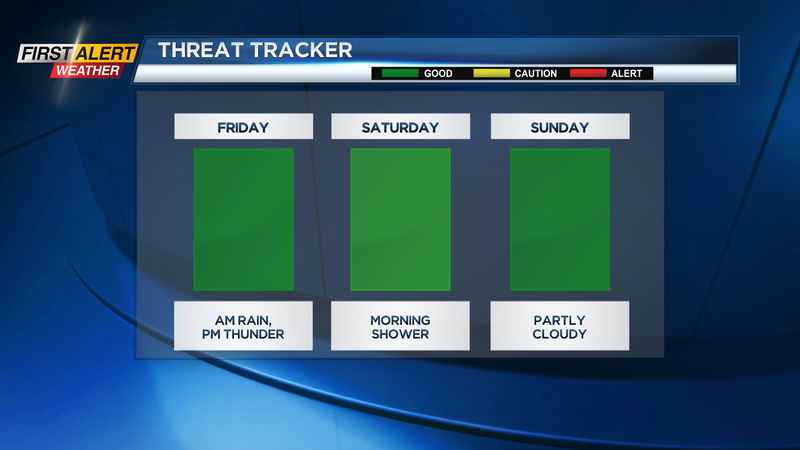
ROCHESTER N.Y. (WHEC) — We’ve enjoyed a lovely stretch of dry and comfortable air this week, but that is coming to an end. Isolated showers this evening will become much more widespread, with a period of steady moderate rain toward morning. The wettest part of Friday will be a few hours in the morning. Showers then become much more scattered, with some thunder possible. Some stronger storms are possible well east of Rochester, mainly in central and eastern NYS. So, severe weather isn’t expected in our area, but a few thunderstorms are possible. We’ll get one more slug of showers into Saturday morning, before rain chances go down significantly for the rest of the holiday weekend. But, if you have outdoor plans Saturday morning, plan on some wet weather. At this point, the showers should pull away around lunchtime or early afternoon, and leave us with a mostly dry afternoon and a little sun.
We’re then dry Sunday through Wednesday, before our next chance of rain by Thursday of next week. The other part of the weather story will be the rising temperatures. Saturday will be our coolest day, with highs near 70 and a cooler breeze. Sunday warms into the 70s, Memorial Day well into the 80s, and Tuesday near 90. We may stay hot for a few more days into the middle of next week, but we’ll be battling a cold front sagging south from Canada. That’ll drop our temperatures back into the 70s and bring some showers to western New York.