First Alert Weather: A few showers to end the week
[News10NBC]
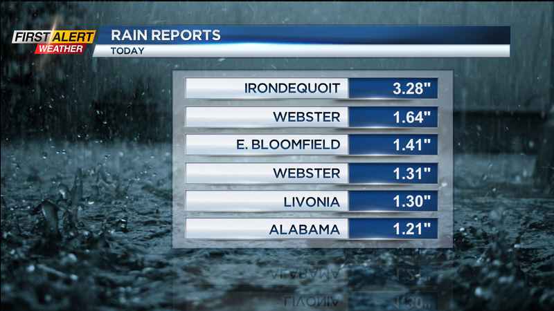
ROCHESTER, N.Y. (WHEC) — The big rain is done, and some locations picked up quite a bit of it! Some spots, mainly along and north of Route 104 recorded 1-3" of rain, with some flooding reported in Irondequoit.
That is gone, and we’re waiting on a cold front. This won’t drop our temperatures much but will bring a few more scattered showers to the area on Friday, along with a good deal of clouds. In fact, we may start Friday morning with some low clouds and areas of fog.
The weekend is shaping up to be fairly decent, but not perfect. Saturday starts with clouds, and maybe a few brief showers south of Rochester. Otherwise, the air dries out, humidity drops and sunshine returns into the afternoon. Sunday starts with sun and ends with a few showers later in the day. Highs both days will be in the upper 70s and lower 80s.
We’ll crank up the heat and humidity again next week, with highs well into the 80s, dew points climbing into the 60s and 70s, and that will lead to scattered showers and some storms, especially by Wednesday and Thursday.
———————————
Download the WHEC First Alert Weather app to stay up to date while on the go.
Watch the latest full forecast at whec.com/weather.