First Alert Weather In-Depth: Heat or no heat for Rochester
[anvplayer video=”5106723″ station=”998131″]
ROCHESTER, N.Y. (WHEC) — In the past, I have talked about the contrast of the temperature across the country this time of the year. Whether it is north or south and east or west, it has an impact through the spring season.
The weather pattern is the big picture for the U.S. for Thursday, Friday and Saturday. This trough of low pressure is going to hold the temperature down for at least a couple of days. Then we see a major change in this pattern for next week. That trough will move into the western half of the country and that warmth shifts to the east.
Meteorologists look at this and say there is going to be a shift to warmer temperatures and it could even be summer-like weather. But this can also be a little deceiving and there is a caveat to this for the meteorologist of Western New York. That caveat is Lake Ontario’s lake breeze.
We know that this time of the year Lake Ontario has a water temperature only in the mid-40s. When we get sunshine throughout the day, there is going to be a difference in the amount of heating and the rate of heating. This is a difference from that chilly lake water compared the significant heating over land. The heating of the land happens very rapidly. Then the air begins to expand, it becomes lighter and begins to rise. This low pressure moves away only to be replaced by the heavier more dense air over the water. That cooler air begins to move inland.
The problem is the change in temperature can play havoc with our weather forecast—especially north of the New York State Thruway.
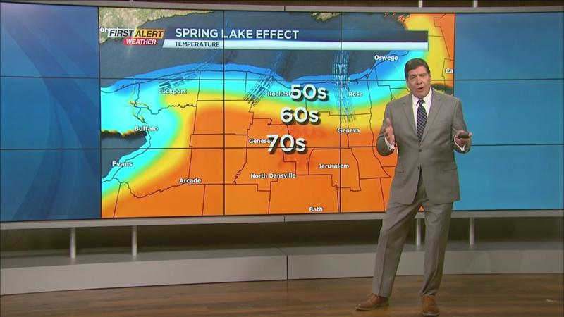
[News10NBC]
How warm do we really get as we go through the next seven to ten days? Stay tuned!