What’s behind the unsettled weather and will it continue?
[anvplayer video=”5045542″ station=”998131″]
ROCHESTER, N.Y. (WHEC) — While dry weather and heat were the primary concerns for the greater Rochester area in June, since the calendar flipped, the weather has been unsettled.
With the Rochester area seeing more rain and strong storms, some may be wondering where the warm weather went and what August has in store.
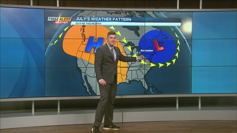
June’s weather pattern brought heat and dry air in place across our area. That’s because a ridge over the Western United States and a ridge just off the Atlantic kept the jet stream to our north, allowing us to stay on the hot side and the dry side.
Everything switched in July. The ridge over the Western U.S., that maintained itself while that ridge over the Atlantic, broke down, allowing more unsettled weather to return.
Will that dip in the jet stream and that kept us cool and unsettled through the last couple of weeks continue?
[News10NBC]
Over the next few days, models show that upper-level ridge is sitting over the Western U.S. so that’s going to keep that heat in the Western U.S. That dip in the jet stream remains, even as models go into next week, so it looks like weather in the Rochester area will still be on the cool side through the next week.
Will this ridge continue to move east or is it going to move back west and keep us on the cool side?
That’s the question the First Alert Weather team is going to be tracking and watching out for over the next couple of weeks.