First Alert Weather: Another frosty cold night, but summer is on the way
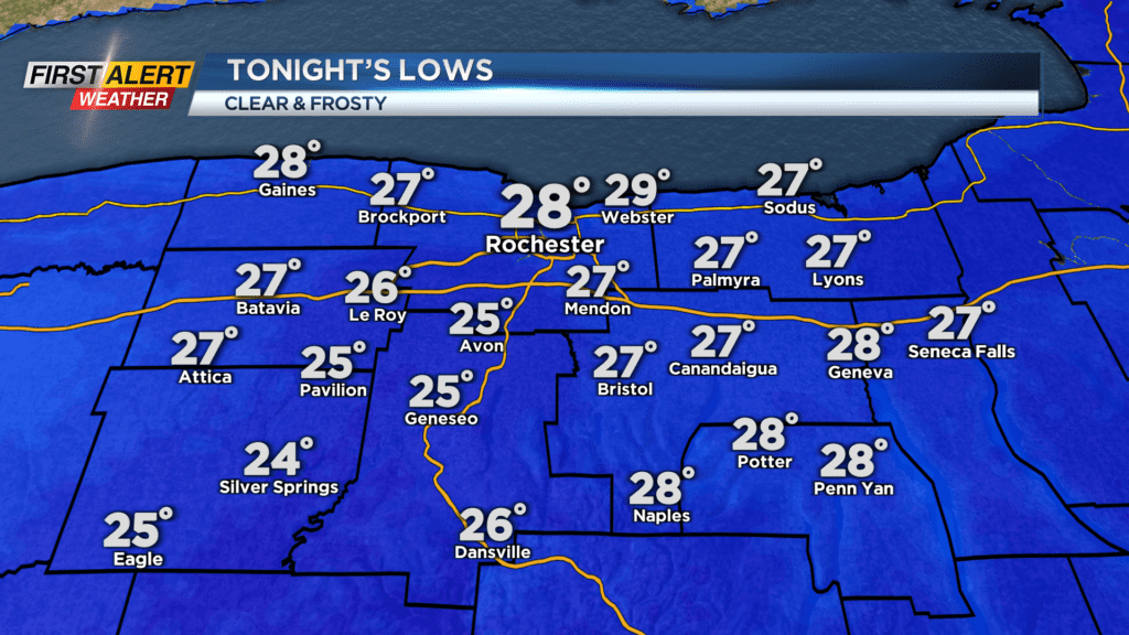
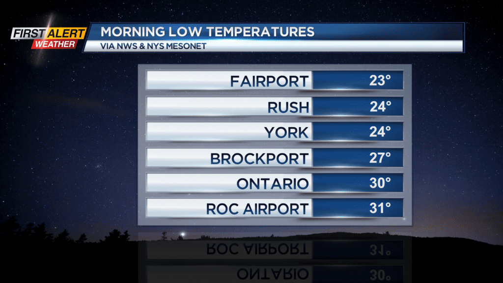
ROCHESTER, N.Y. — Many of us woke up to thick frost on the ground Thursday morning, and we’ll do it again Friday morning with a very similar setup.
A clear sky and calm wind will produce ideal radiational cooling conditions, meaning temperatures will drop quickly Thursday night. Areas away from Lake Ontario will bottom out in the mid and upper 20s, with lower 30s lakeside.
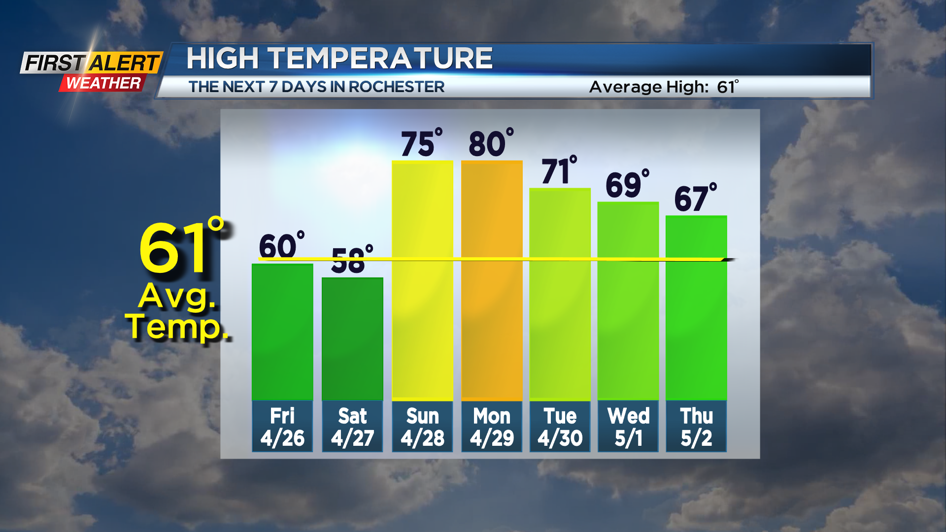
Friday will see another spectacular sky with nearly full sunshine, and despite our frosty start, we should push 60 degrees by the afternoon.
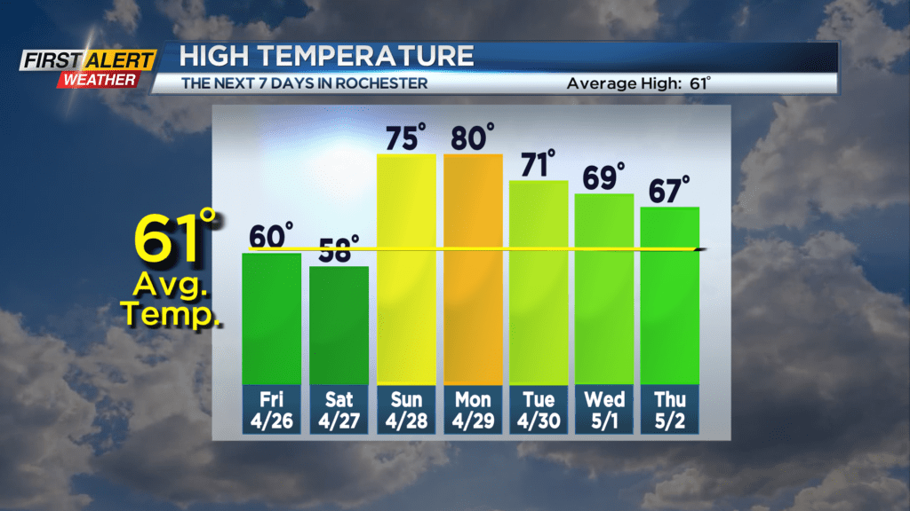
The weekend will be less perfect, but will start to turn warmer. A warm front lifting through on Saturday will bring some scattered rain showers, especially midday into the afternoon. This will help to push us into the 70s for Sunday.
We’ll feel a little more humidity, and there may be enough instability to produce a little thunder. Our warmest day of the week (and of the season so far) will be on Monday, when many spots will push into the lower 80s for the first time this year. That mid-summer warmth will be short-lived though, as a cold front moving through will drop us into the lower 70s for Tuesday and produce some scattered rain showers, possibly some thunder.
We don’t have any severe weather in the cards at this point, so we remain “green” on the First Alert Threat Tracker.