First Alert Weather: Chilly air welcomes in winter, but it doesn’t last

ROCHESTER, N.Y. — Welcome to winter! It officially arrives just before midnight Thursday, and we’ll certainly feel like it.
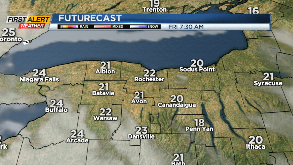
Temperatures overnight will drop into the teens away from Lake Ontario thanks to a clearing sky. This means it’ll be a chilly start to Friday morning, and we’ll stay cool despite a fair amount of sun. The wintry feel won’t last, though. Temperatures will climb back into the lower 40s on Saturday with a few showers around as a weak wave of low pressure moves by.
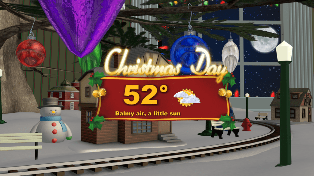
We should clear that out by Christmas Eve on Sunday, but keep the clouds around. Temperatures will climb a few more degrees into the mid 40s. Christmas Day will be a balmy one this year, with highs in the 50s. We won’t be setting any records, but it will be the warmest Christmas Day for us in eight years. We’ll also stay dry through the day, but rain will be knocking on our door.
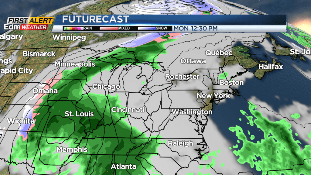
Our weather turns more active right after Christmas, as a storm system begins to move in. It’ll first bring us some rain on Tuesday and Wednesday, followed by chillier air returning on Thursday — which may mix in some snow showers later in the day. There are signs that we get a blast of chillier air and perhaps some snow showers by Friday of next week. So if you’re patiently waiting for winter, stay tuned.