First Alert Weather: From rain to snow this weekend

ROCHESTER, N.Y. — We are starting off this Saturday on the unsettled side as light rain and moved in Friday night.
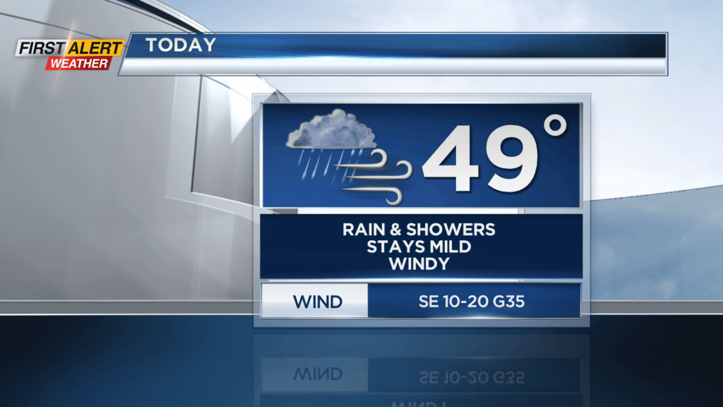
This light rain will persist through much of Saturday and could be locally heavy at times. Temperatures on Saturday will remain mild but will only sit in the upper 40s through the day. Rain will continue into Saturday night and we will turn colder as a cold front passes by. One thing to note, do not forget to “Spring Forward” Saturday night as we push our clocks one hour ahead!
We will then begin to mix with wet snow showers by Sunday morning. The colder trend will continue for Sunday as temperatures start off near 40 degrees but drop to near freezing by Sunday evening. Mixed showers will also transition over to all snow showers by Sunday afternoon and continue into Sunday night. Accumulation will be hard to come by during the day on Sunday, but once the sun begins to set Sunday evening we will see some accumulation on colder surfaces and untreated roadways.
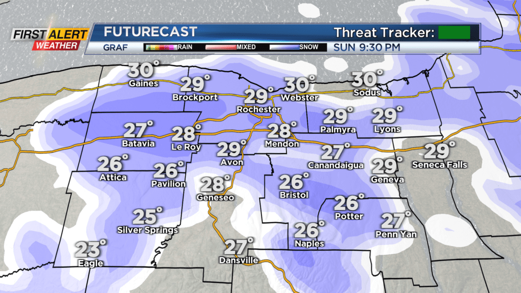
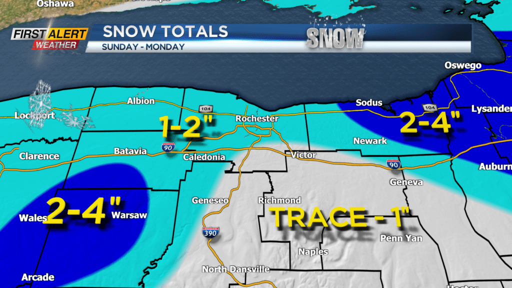
Snow showers will continue into Monday morning and temperatures will drop below freezing Sunday night. With that, an inch or two of snow will be possible by the time we wake up on Monday for most of us. Higher elevation to the south could see upwards of four inches of snow, and so could areas east of Rochester.
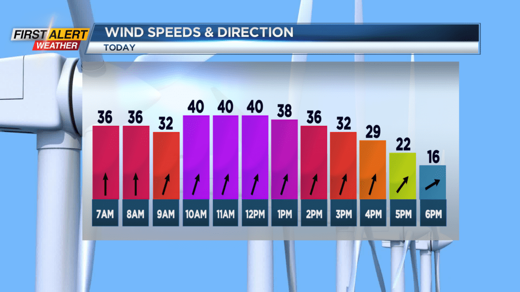
The Threat Tracker will remain green for Sunday and Monday as widespread issues will not be likely. Even with that said slick spot or two will still be possible early Monday. Also to note, the winds will be a factor both Sunday and Monday, and as temperatures drop the wind chill will too. Expect wind chills by Sunday evening, and early Monday morning, to be in the teens with gusts near 40mph.