First Alert Weather: Tracking light snow and wind for late Wednesday into Thursday
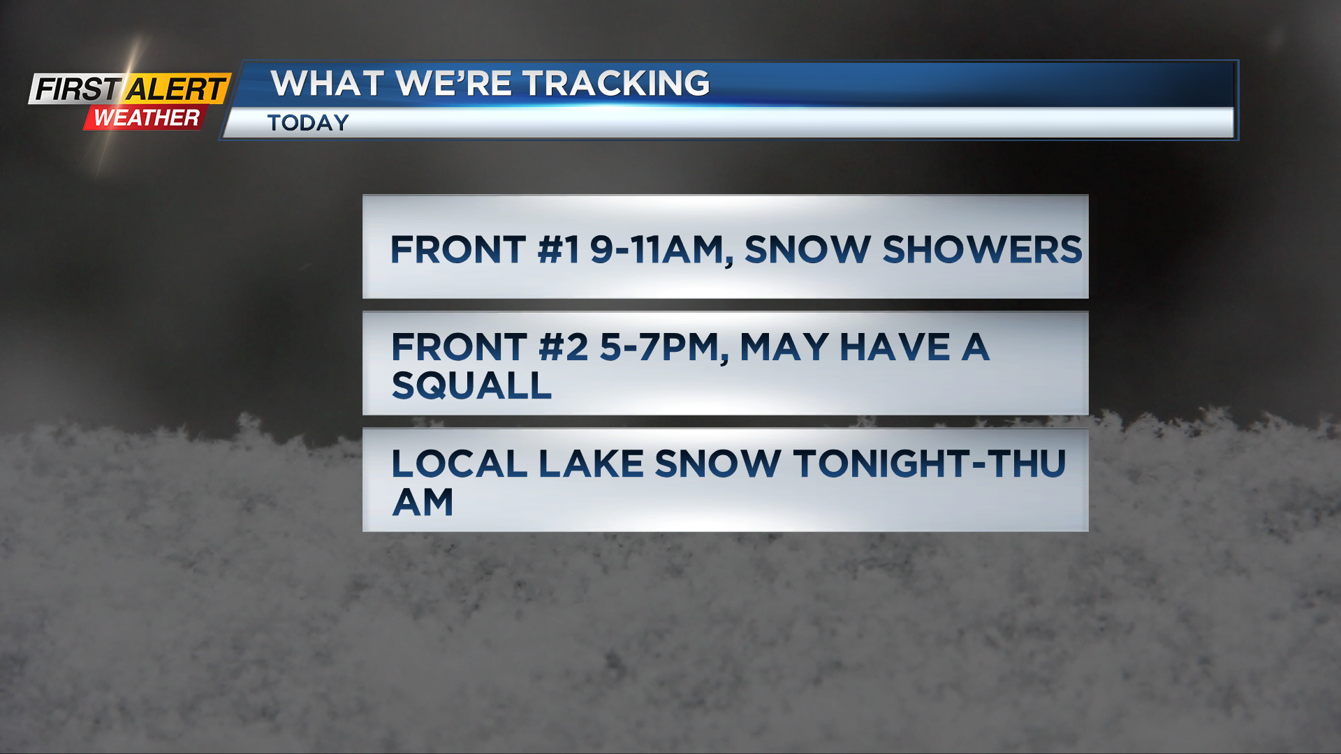
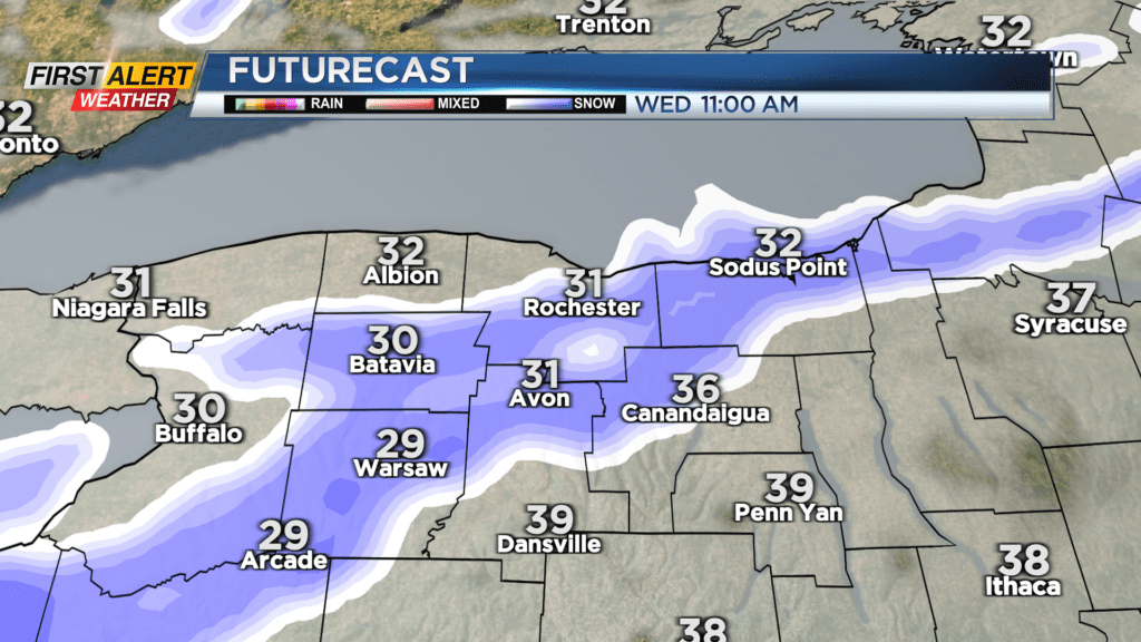
ROCHESTER, N.Y. — After a quiet Wednesday morning with a little sunshine, the first front will move in mid to late morning with snow showers moving through the region.
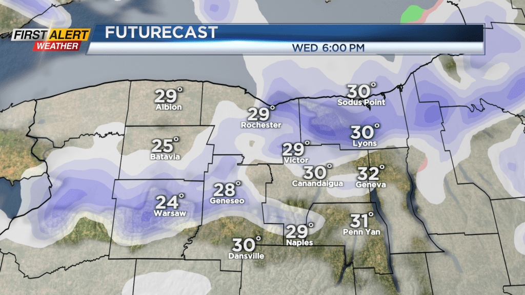
Expect a coating on snow on the grass but roads will be just wet with the first round of snow. Keep an eye out for the second front, as that will pack more of a punch later in the afternoon with a brief squall possible. That may cause roads to become snow covered and slick for the afternoon commute.
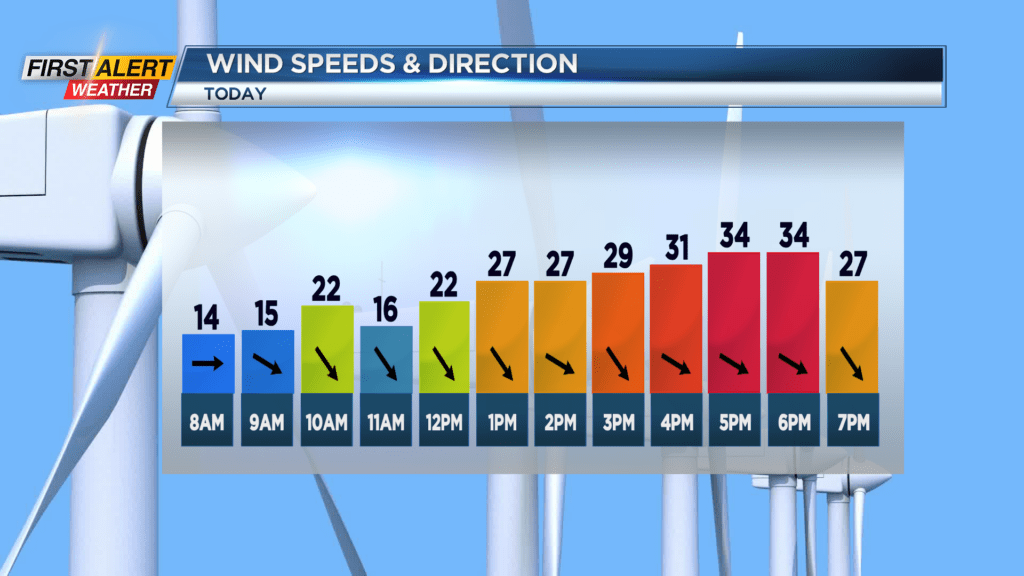
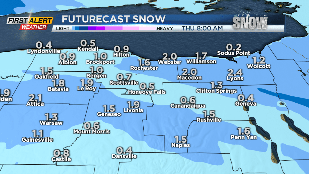
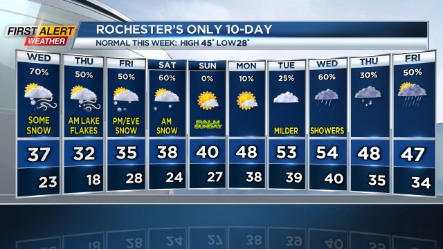
Wind gusts over 40mph possible along and behind that second front. Local lake snow and flurries will develop on Wednesday night into Thursday morning with most of us seeing a coating to an inch.
Where the bands are more persistent, a few inches are possible into Thursday morning. That snow will clear during the day as windy and cold weather is the story on Thursday afternoon. Also keep an eye on a system for later Friday into Saturday morning that may bring some slushy snow to the region.
Stay tuned to News10NBC for the latest updates on the possible snow squall later on Wednesday afternoon.