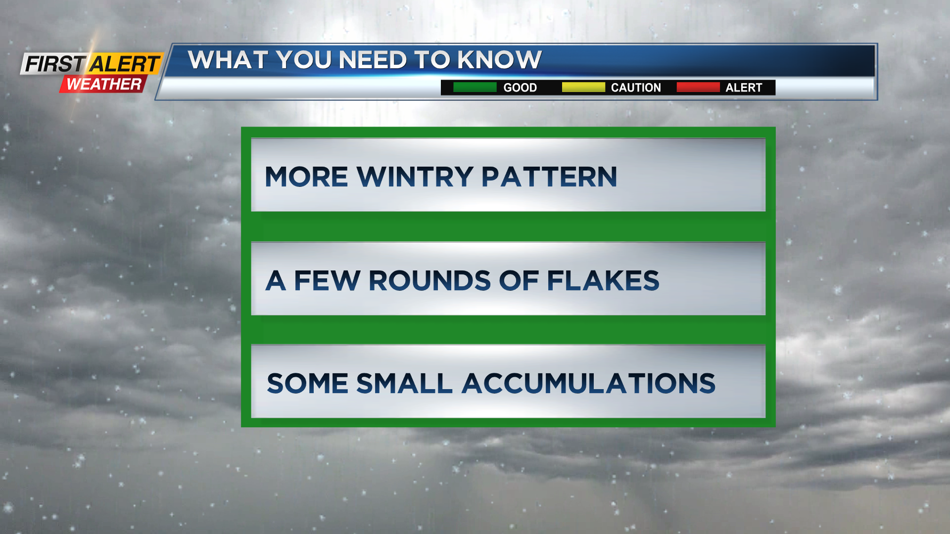
First Alert Weather: Tracking snow showers on Tuesday and next few days
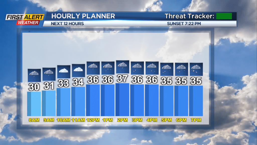
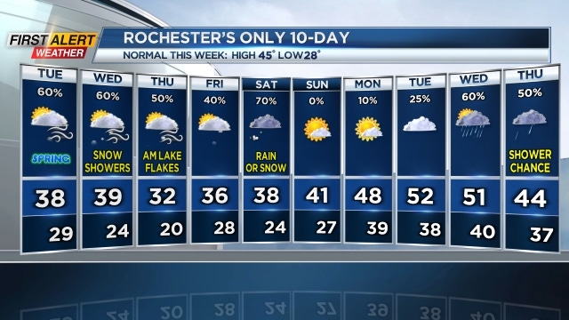
ROCHESTER, N.Y. — We’re tracking snow showers on Tuesday morning that may bring a dusting to the region but no major issues to start the day.
There will be breezy and cold weather with mixed skies late into the morning and early into the afternoon, before snow showers increase in coverage later in the day.
Plan on some minor accumulations later Tuesday with a coating to an inch likely but mainly on grassy surfaces. It won’t make a huge impact for travel.
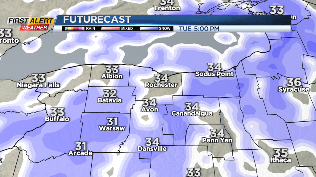
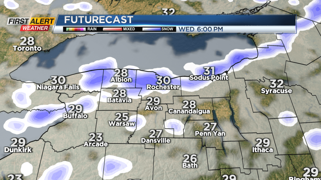
Evening snow showers will taper to flurries on Tuesday night into Wednesday morning. Another front will arrive Wednesday afternoon with a burst of snow and wind.
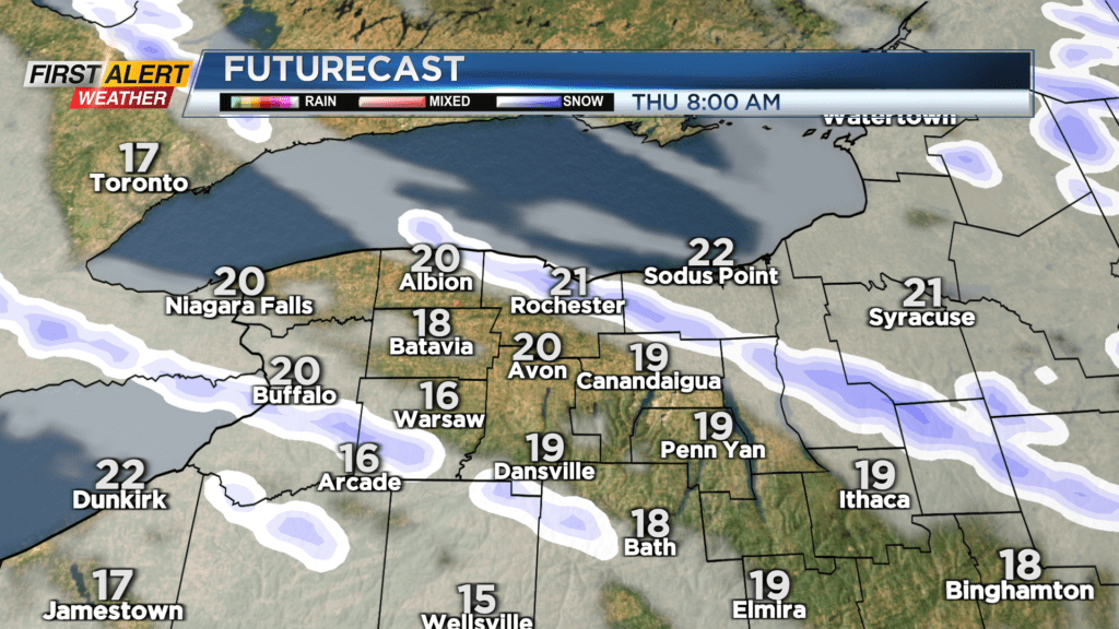
Following that front, some very cold air will arrive into Thursday with local lake snows in the morning. The amounts will vary from a dusting to a few inches in the lake bands. Everyone will deal with the cold.
Temperatures on Thursday will stay in the 20s with feel like windchill readings in the single digits. Keep an eye on the Saturday forecast as a storms system may bring some wet snow or a wintry mix to the region to start the weekend. Stay tuned to News10NBC as we have lots to track this week with timing the snow showers and updating the accumulations expected.