First Alert Weather: Yellow Alert: A Winter-like weekend before a return to Spring
ROCHESTER, N.Y. — We are waking up to wintry scenes around our region as snow continue through Friday night leaving a blanket of accumulation.
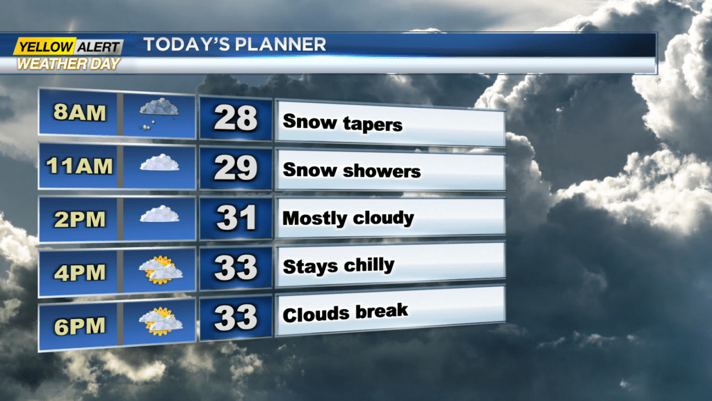
The First Alert Weather Team issued a Yellow Alert for Saturday that will continue through the morning hours before the Threat Tracker goes back to green Saturday afternoon. There are a few slick spots on the roads early Saturday morning due to the snow, and there is still a bit of snow falling. Snow showers will taper by the afternoon, and we will be left with mostly cloudy skies later on.
Additional snow will be minor, only a trace or half an inch is expected. It will remain chilly Saturday with highs in the mid-30s. We will continue to see things dry out Saturday night and skies clear by Sunday morning.
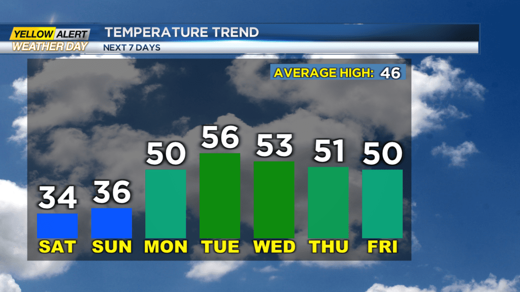

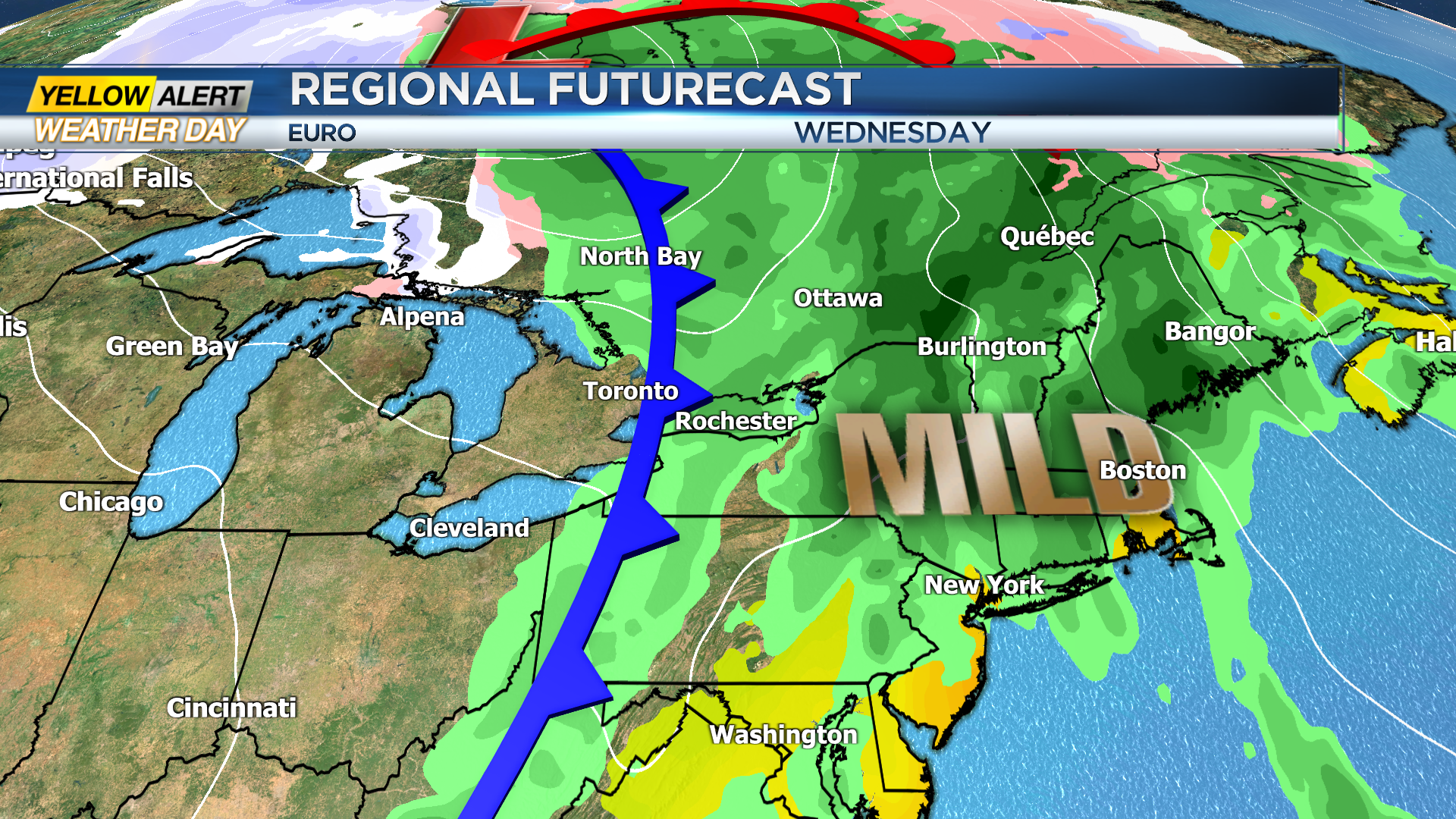
For Sunday, we will remain cold with highs in the 30s, but it will come with an abundance of sunshine! Although we are chilly this weekend, spring is expected to return this week. Highs return to near 50 as early as Monday afternoon and we will stay dry until Wednesday when a cold front passes through with a few rain showers.
This front will not be that strong which means that a big cool down is not expected behind it as highs remain near 50 into Easter Weekend.