First Alert Weather: Yellow Alert for accumulating snow and sleet Friday evening and night
[anvplayer video=”5165590″ station=”998131″]
ROCHESTER, N.Y. – We are still on track for our next winter storm to deliver some accumulating snow, and some sleet starting Friday afternoon, and tapering Saturday. This will be a modest winter storm, and a tricky one to forecast.
The finer details on when and where we start to see sleet mixing in with the snow, and that will affect snowfall totals. Bottom line: Friday morning remains quiet, with a little sun to start the day. Clouds move in quickly, and snow develops during the mid to late afternoon. Expect wet snow to overspread the region from south to north, starting around 3 to 4 p.m. in the Finger Lakes, and the 4 to 5 p.m. in the Rochester area.
The snow will fall at a moderate clip, and begin to accumulate on roads as the commute goes on. The snow will fall heaviest through about 10 p.m. with road conditions likely getting worse *after* the evening commute. So, if you have Friday night plans, just take it a little slower.
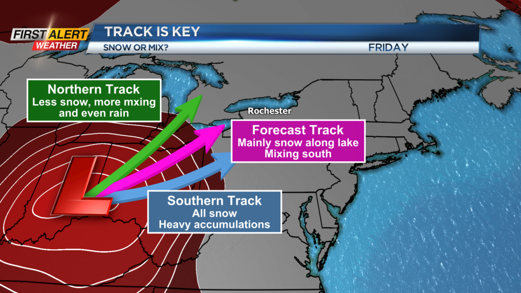
Sleet will likely begin to mix in, especially south of the Thruway, starting around 7 or 8 p.m. This will cut down on snowfall amounts where we do see the sleet mixing with snow. This will also make roads extra slick. Areas north of the Thruway may see anywhere from four to eight inches of snow through Saturday afternoon, when the snow ends. South of the Thruway, including the Finger Lakes should see less snow, with a general two to four inches of accumulation, which includes some sleet. The one exception may be in the higher terrain, where we’ll see snowfall amounts amplified.
This is a very fickle forecast, and the devil will lie in the details, which we’ll likely have to iron out as the system moves in. Stay with the First Alert Weather Team as we continue to fine tune the forecast details.