First Alert Weather: Yellow Alert Friday night into Saturday morning for accumulating snow and mix
ROCHESTER, N.Y. — We’ve been tracking some snow to end the week and start the weekend, and we’ve put up a Yellow Alert for Friday night, as this system looks like it’ll have an impact on roads to kick off the weekend.
We’re nice and quiet Thursday night through much of the daylight hours Friday. In fact, we should see some sun to start Friday, but that will be taken over by clouds. Our first snowflakes will begin to fall late in the afternoon or early evening, but will be light enough, and falling while the sun is still up, which will greatly limit any sort of accumulation.
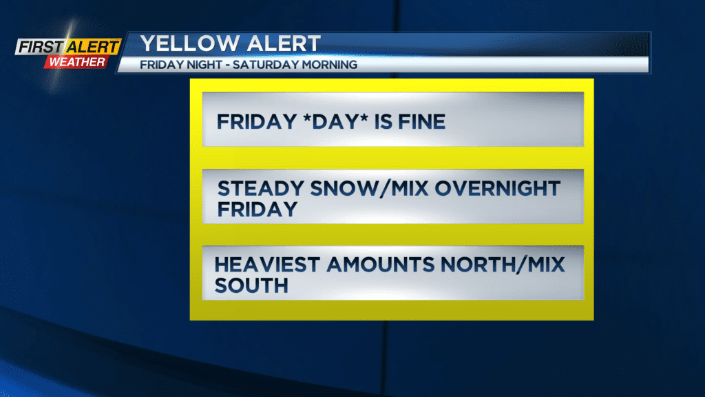
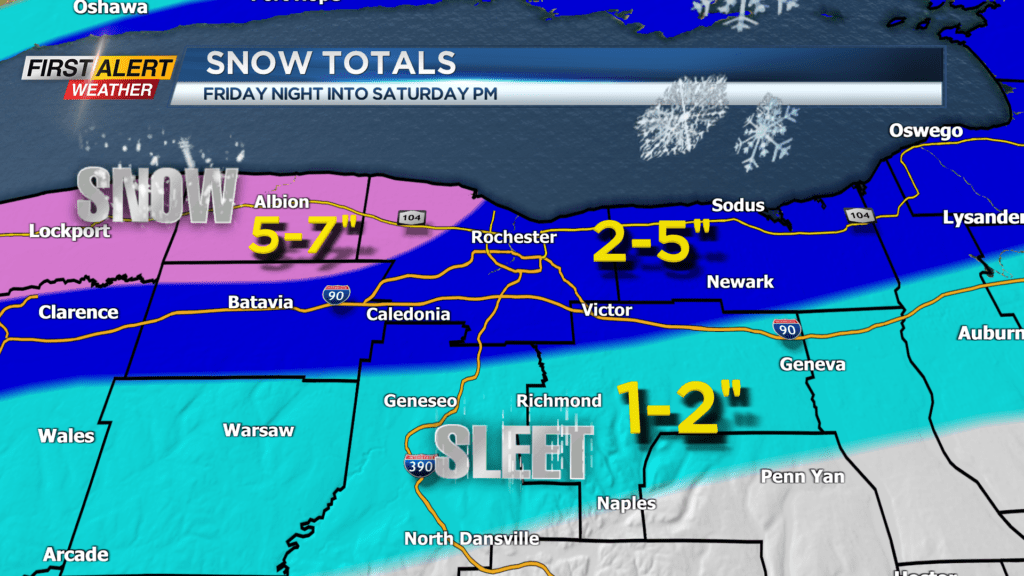
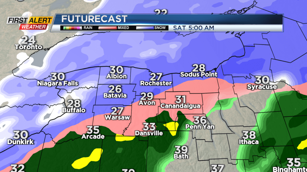
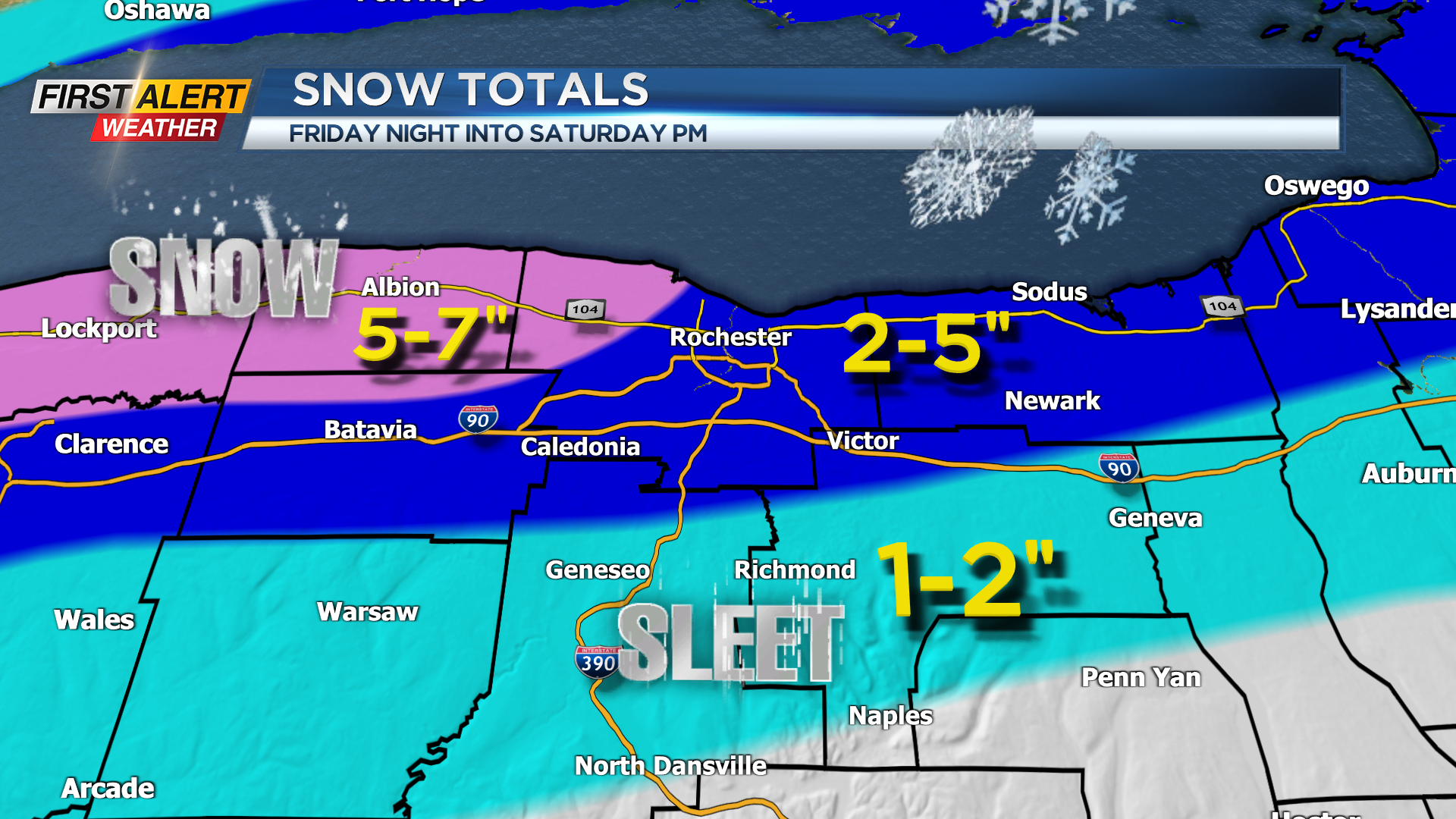
Once the sun goes down, the steadiest snow will begin to fall, at which time we’ll start to see it accumulating on the grass and roads. The snow will fall fairly steadily overnight, before tapering Saturday morning. Snow isn’t the only precipitation type expected. We’ll likely see a wintry mix of snow and sleet along and south of the Thruway, with a little freezing rain and rain mixing in further south into the southern Finger Lakes. Because of this mix, we expect to see a wide range of snowfall, with a half foot of snow possible north and west of Rochester, and less than an inch of snow into the Southern Tier and Southern Finger Lakes.
Roads will likely be slick if you are out overnight Friday and Saturday morning, but should improve quickly Saturday morning as the precipitation pulls away.
Stick with News10NBC on air to see our updated Snow Tracker, so you can track when the steadiest snow will fall in your town, and online for the latest updates.