First Alert Weather Yellow Alert: Heavy rain and flooding possible Friday
[anvplayer video=”5147128″ station=”998131″]
ROCHESTER, N.Y. We’re at the end of the road as far as our warm, dry and sunny fall goes, with big changes on the way starting tomorrow.
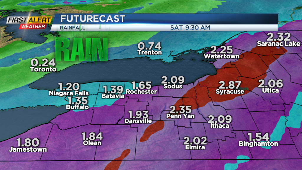
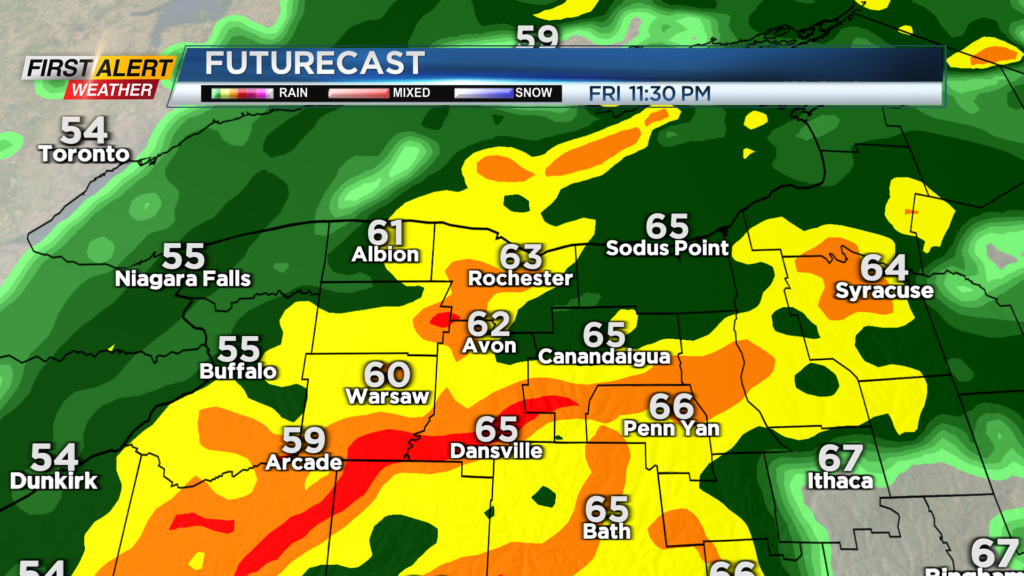
The remnants of what was Hurricane Nicole will begin to move into the Mid-Atlantic and Northeast overnight. Friday morning starts dry and mild, but rain arrives around noon from south to north, and will become steady almost immediately.
We may get a brief lull in the steadiest rain by late afternoon or early evening, but it is expected to fill back in again, becoming heavy through the first part of the overnight. This is when we have the best possibility of seeing some flash flooding and poor drainage flooding.
We’ve been exceptionally dry, which means the ground will be able to absorb most of the rain, though the ground may be so dry and hard that some of that rain will run off. In addition to that, as you look out your window, you’re probably looking at piles of leaves.
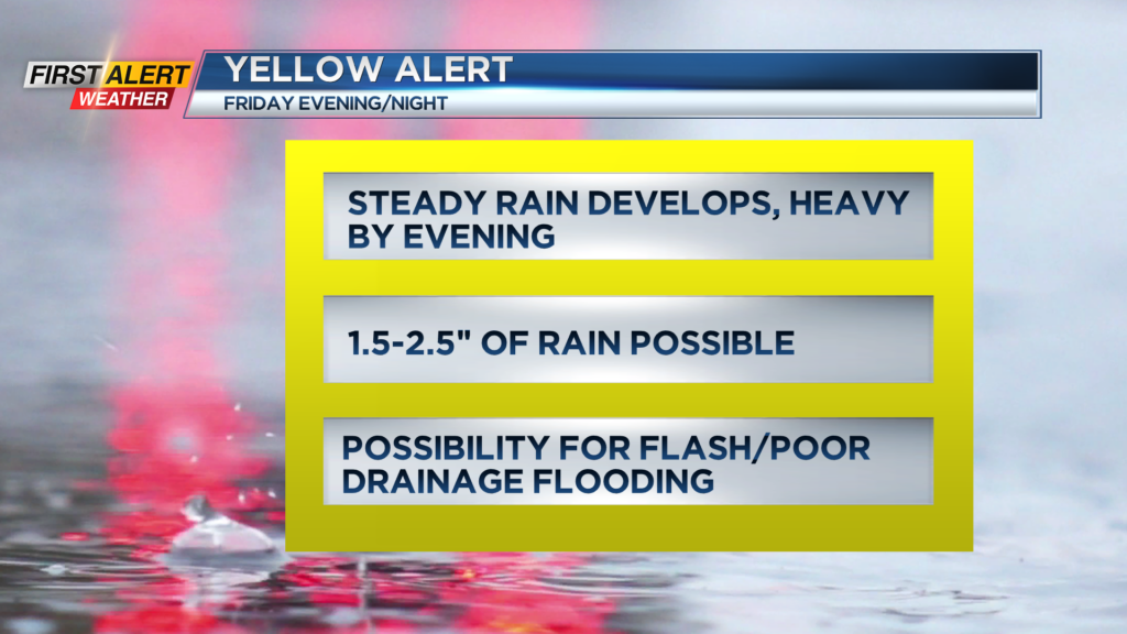
These have a habit of clogging storm drains and causing street flooding. So, be on the lookout for standing water and perhaps some flooding on roads late Friday. A Yellow Alert remains up for this potential.
Most of the rain is gone by Saturday, but it’ll be far from a beautiful weekend day. We’ll see a mostly cloudy sky, with temperatures falling back through the 40s. Some lake-enhanced rain and wet snow showers begin to move in later in the afternoon and evening, but nothing that’ll accumulate locally.
We're at the end of the road as far as our warm, dry and sunny fall goes, with big changes on the way starting tomorrow.
Sunday turns chillier with some lake effect, mainly south of Buffalo. That does mean we could see some flakes flying during the Bills game on Sunday afternoon. Our weather will take a very noticeable turn for next week, with cooler-than-average temperatures in the 30s and lower 40s, and off and on lake effect snow showers.
At this point, no significant accumulations, but we may be talking about our first measurable snow next week. Stay tuned to News10NBC for more information.