Yellow Alert continues tonight for lighter snow and wintry mix
[anvplayer video=”5165819″ station=”998131″]
ROCHESTER, N.Y. The heaviest of the precipitation is over, but we’re not quite done with everything yet.
There was enough instability in the atmosphere Friday night as the snow and sleet came down the heaviest, that many of you saw and heard thundersnow! As expected, several inches of snow and sleet fell, and we’ll tend to see the precipitation filling back in again overnight.
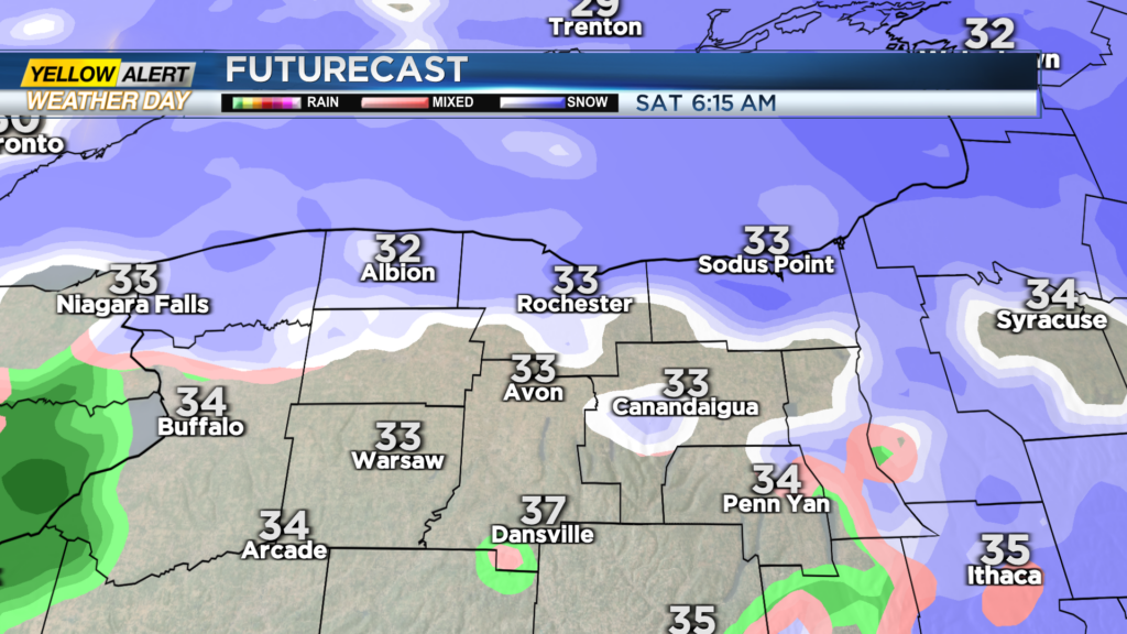
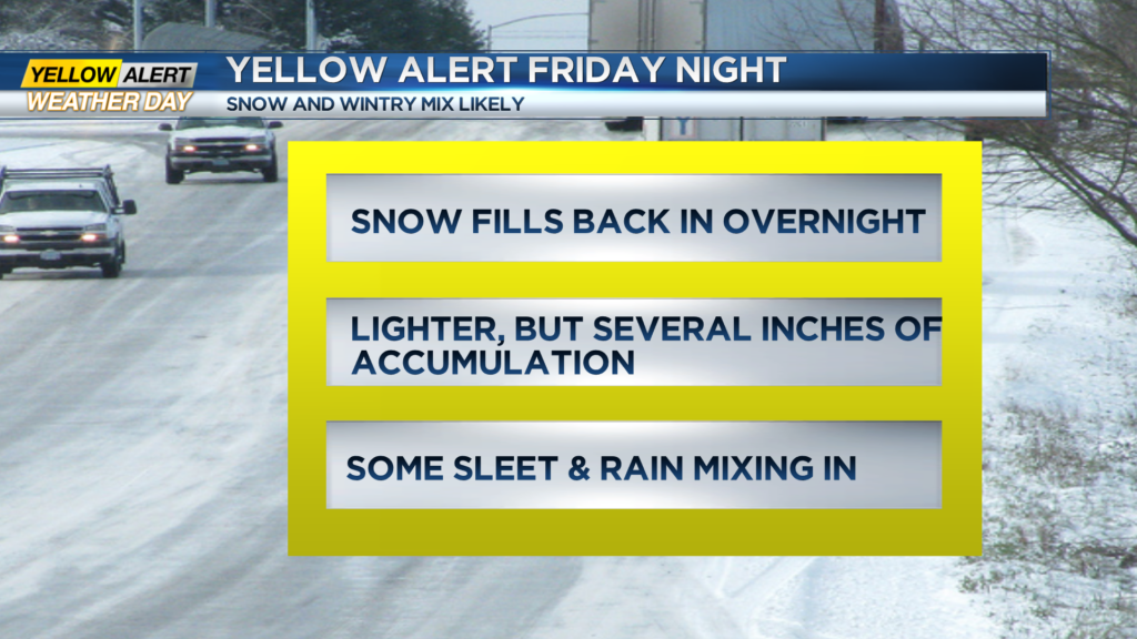
It’ll be lighter, and accumulations will be held down to another inch or two, mainly for our lakeshore counties, as more in the way of sleet and even some rain is expected south of the Thruway. We’ll keep the Yellow Alert up until early Saturday morning, until the snow tapers. Roads may still be slick and icy in some spots, especially side streets and lesser traveled or unplowed roads.
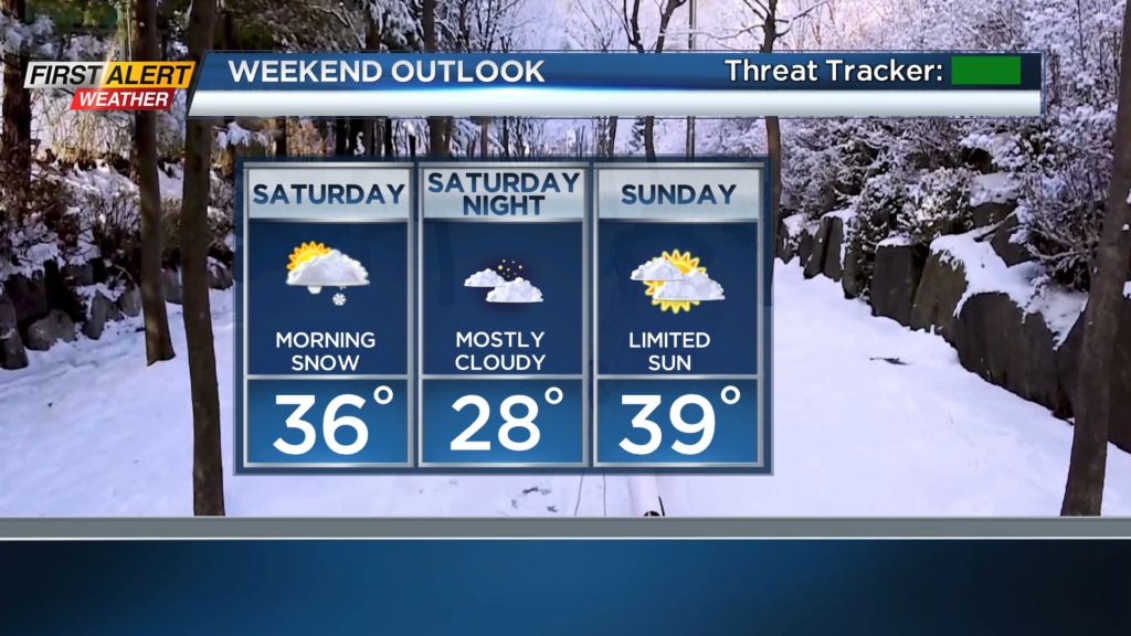
Snow will slowly taper Saturday morning and into the early afternoon hours, with less than an inch or two of accumulation for most. Wake up with First Alert meteorologist Alex Bielfeld starting at 6 a.m. Saturday morning for the latest on the snow and how much fell overnight.