First Alert Weather: Cold & quiet weekend, storm possible next week
[News10NBC]
ROCHESTER, N.Y. (WHEC) — Light lake effect flakes that were flying for much of Friday will tend to linger into the overnight, and even early Saturday before ending.
Most will see less than another 1" of snow before it ends, and some sun returns Saturday afternoon. The cold will be the bigger weather story this weekend. While coastal New England gets hammered with blizzard conditions, we’ll just have to deal with chilly air. Highs in the lower teens on Saturday combined with a brisk wind will make it feel below zero for much of Saturday. A Wind Chill Advisory is up for areas south of the Thruway, where the air will be the coldest Saturday morning.
Sunday will remain fairly quiet with a little bit of sun and a few passing flurries. Temperatures will make their way back into the 20s. Monday and Tuesday are also quiet with dry weather and moderating temperatures into the 30s.
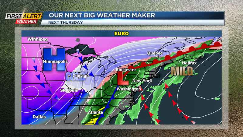
Storm threat next week: Our attention will turn to a developing storm system toward the middle to end of next week. The latest guidance suggests a storm track further south, which would limit the amount of warm air that gets drawn into WNY. Because of that, we’ve lowered temperatures a bit on Wednesday and Thursday, but still milder than where we’ve been! Depending on the exact track of this storm, we could see anything from rain to ice and snow, or a more significant accumulating snow if the track is slightly south of us. The main impacts would be felt on Thursday and early Friday, followed by another blast of very cold air for next week.
We’ll keep you updated on changes to the track, and what it means for you, and we should have a better idea of the main impacts by the end of the weekend.
_____________________
Download the WHEC First Alert Weather app to stay up to date while on the go.
Watch the latest full forecast at whec.com/weather.