First Alert Weather: A hint of fall to the air
[anvplayer video=”5127738″ station=”998131″]
ROCHESTER, N.Y. (WHEC) – If you’re tired of the hot and humid days, and warm and muggy nights, you’re in luck! The winds of change are blowing. Monday’s low temperature never dropped below 74 degrees, which ties the record warm low of 74 from 1900. But those warm nights are gone.
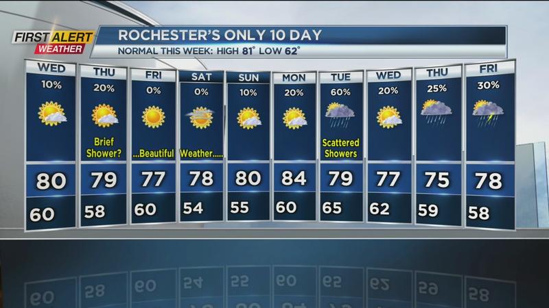
After a run of sweltering summer weather, we’ve flipped the switch, and have a hint of fall in the air. Most of Tuesday was spent in the lower 70s, and we’ll drop into the 50s away from Lake Ontario overnight as the sky begins to clear. With cool air aloft, and a warm Lake Ontario, we may get some lake clouds, and perhaps a stray lake rain shower into early Wednesday morning. Our air continues to dry out on Wednesday, leaving us with a mix of clouds and sun, and very comfortable humidity levels. Another weak cold front will drop south on Thursday, but it’ll do little other than bring us a brief midday shower, and keep the comfortable weather in place. Highs on Friday fall back into the mid-70s, upper 70s on Saturday, and near 80 on Sunday.
A bit more moisture will work back in by early next week, but nothing compared to the humidity and heat we had last week, and 90s are nowhere in sight for us. Our next real rain chance comes on Tuesday with scattered showers or some thunder.