First Alert Weather: Going from summer to fall with wet weather
[News10NBC]
ROCHESTER, N.Y. (WHEC) — The calendar says today is the last full day of summer. And with temperatures in the mid to upper 70s, it certainly felt summer-like. The recommendation is to enjoy this evening because our pleasant weather will slowly come to an end.
The News10NBC First Alert Weather Team has been tracking a cold front and an associated low-pressure system that is advancing on Western New York. As a result, the chance of rain showers will be on the increase after midnight. The temperature will only fall into the mid-60s overnight.
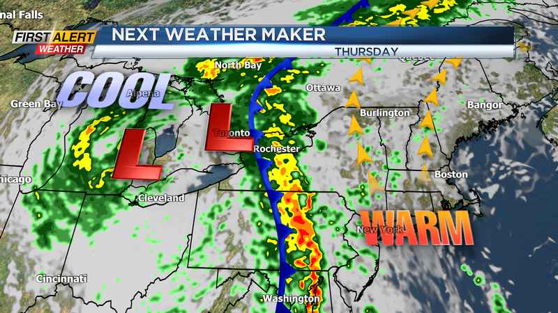
Wednesday the autumnal equinox will officially arrive at 3:21 p.m. However, even with the fall season arriving on the calendar we still expect above-average temperatures for the day. Wednesday the mercury will still be in the mid-70s with some wet weather. We do not expect a washout, but it will be a good idea to keep the umbrella handy as light showers will be off and on. Once we get to Wednesday evening the rain is likely to become steadier and heavier. At this point, no flooding is expected, but there could be significant ponding on area roads for Thursday morning. The associated cold front will be moving east of Rochester by Thursday afternoon and this should take most of the heavier rain into central New York. As result, conditions will improve with just scattered showers and temperatures in the mid-60s.
The remainder of the week should bring changeable weather with just a hit or miss scattered shower for Friday, Saturday, and Sunday.
——
Download the WHEC First Alert Weather app to stay up to date while on the go.
Watch the latest full forecast at whec.com/weather.