First Alert Weather: Heavy rain at times Thursday, cooler Friday
[News10NBC]
ROCHESTER, N.Y. (WHEC) — An impressive area of low pressure and upper level low will produce a rain event for us on Thursday.
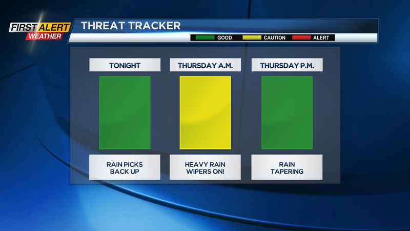
There are no flooding headlines up for this, and flooding isn’t a huge concern, but the rain will fall heavy at times on Thursday.
The details: Rain fills back in Wednesday night, falling heaviest Thursday morning, likely during the morning commute. There may be some ponding on roads, and wipers will need to be on high for the first part of the day. Rain will taper by early to mid-afternoon from west to east, and we may even see some sun before it sets. Many spots will see upwards of an inch of rain, some locations up to 1.5". Again, widespread flooding isn’t expected, but you may see some puddles and ponding. Temperatures will drop back behind this low, with highs dropping back into the 60s by afternoon and on Friday. Friday will have a very fall look and feel, with highs once again in the 60s, a busy wind and some lake rain showers off of Lake Erie, especially west of Rochester.
The weekend: Saturday should briefly pop back into the 70s, with another cold front bringing a few later afternoon/evening showers, followed by a few more showers on Sunday. That being said, the weekend will not be a washout. The fall feel will continue into much of next week, with highs holding in the 60s much of the next week.
_________
Download the WHEC First Alert Weather app to stay up to date while on the go.
Watch the latest full forecast at whec.com/weather.