First Alert Weather In-Depth: Rainfall and Stream Gauge Measurement
[anvplayer video=”5061290″ station=”998131″]
ROCHESTER, N.Y. (WHEC) — What’s the old saying? When it rains it pours.
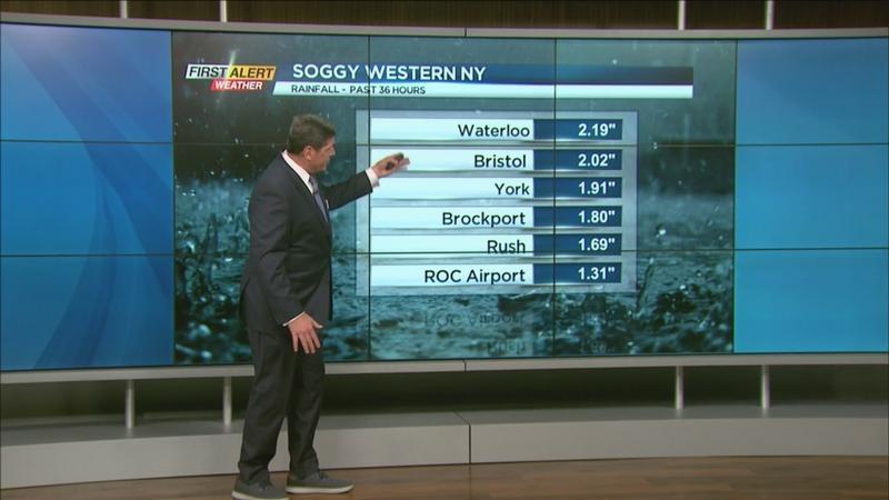
Over the last couple of days, we didn’t have much in the way of rainfall but look at the difference. Sunday the National Weather Service at the airport reported well over an inch of rainfall. Some of the outlying areas, such as Bristol and Waterloo got more than 2 inches of rain.
All that water that’s running off goes into the area creeks and streams. The only reason why we didn’t have a lot of flooding is that that rainfall happened over 36 hours.
As waterways begin to rise we keep track by using an automated stream gauge. There’s a website that you can go to to get this information.
Each map uses dots and each one represents a stream gauge. Darker colored dots represent where water flow is running high.
[News10NBC]
One location of initerest to Meteorologist Glenn Johnson is Honeoye Creek. Earlier in the week, it only had about 3 feet of water, but going into Sunday, it doubled, going up to 6 feet in a very short amount of time.
There is still some ways to go before the creek is in danger of flooding, and fortunately, the rain is tapering for now.