Some showers in the forecast, but the wet weather will not last very long
[News10NBC]
ROCHESTER, N.Y. (WHEC)— After a fine late September day for Western New York some changes coming for this evening. A cold front will cross the area and with the passage of this front, a few showers will be possible.
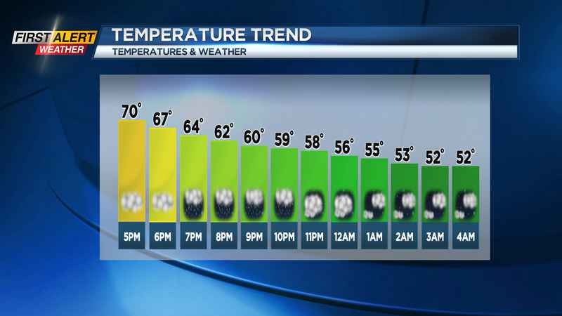
The chance of any wet weather will be found primarily before midnight. Then partial clearing should happen later tonight as the front moves into eastern New York. Expect the temperature to fall through the 60s with a low near 50° overnight.
The second half of the weekend looks to bring dry and slightly cooler weather. You can expect partial sunshine and breezy at times. The temperature will only rise into the upper 60s. If you are heading out to the Bills game you can expect similar weather conditions in Buffalo. Temperatures will in the 60s at game time and it will be breezy at times. Winds coming in off Lake Erie could gust to near 30 mph.
Another cold front will be cutting through the Great Lakes on Monday with an arrival time in Rochester by evening. As the front approaches, it will turn breezy once again with winds gusting to near 30 mph again. The temperature will rise again into the low 70s.
It should be dry most of the day, but showers and thundershowers will be likely by Monday Evening. As the front passes Western New York it will turn much cooler for Tuesday and Wednesday as the temperature will range from the upper 40s at night to mid-60s during the day.
Just in time to pick out your favorite pumpkin!
————————
Download the WHEC First Alert Weather app to stay up to date while on the go.
Watch the latest full forecast at whec.com/weather.