Weather In-Depth: A very early look at the holiday travel forecast
[anvplayer video=”5070956″ station=”998131″]
ROCHESTER, N.Y. (WHEC) — With a major holiday coming up, the last thing the First Alert Weather Team wants want to see is any kind of travel disruptions due to the weather, but the team also wants to be transparent about the forecast and talk about some possibilities going into next week.
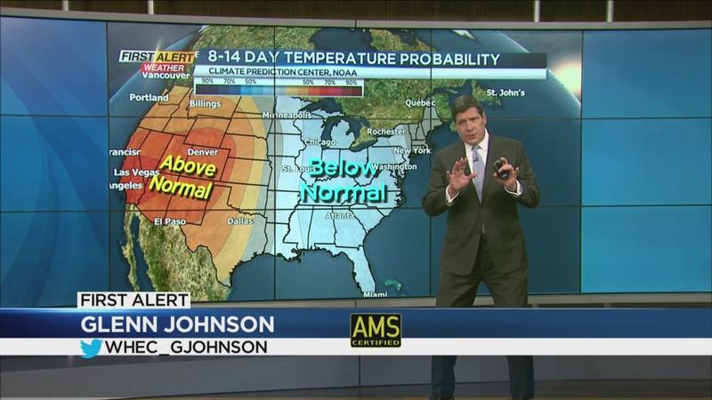
We know we have the cold air in place. Over the next one to two weeks, we are looking at below-average temperatures really through the eastern half of the country. The number one storm track, as a possibility, will be going into Monday and Tuesday. This is one possibility of a storm cutting through the Great Lakes. This would be the more vigorous storm system. If it were to happen, this storm track would produce rain changing over to snow and eventually going over to some heavier snow squalls. This would happen as sharply colder air moves into Western New York. This is the scenario that would more likely produce travel disruptions.
The number two scenario is another possibility. The storm track would come in just south of Rochester and on this track, the rain would last a little bit longer and the amount of snow will probably be much less. This is the kind of scenario most of us probably would like to see.
This is the American computer model, the GFS, shows some significant accumulation here in Western New York Monday, going into Monday night and into Tuesday. Again, it is still highly questionable. The other model is the European model, which shows much less snow. Maybe an inch or two around the area. We would still get some of the inevitable lake effect snow south of Buffalo.
If you are a winter enthusiast, I think there is no doubt you are going to be happy about this weather forecast. But travel-wise, this needs to be watched very closely. We will focus on this as it becomes clearer as we go through the next couple of days.