Winter weekend followed by gradual warmup into December
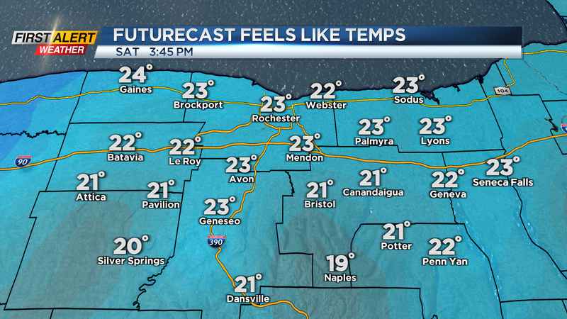
ROCHESTER, N.Y. (WHEC)— A chilly day is expected today with temperatures in the mid and low 30s along with breezy conditions. The breezy conditions will again make it feel colder out there as wind chills remain in the 20s this afternoon.
The good news is that it will be mixed with sun and clouds, but the sun won’t do much justice as it will continue to be chilly. An isolated lake effect snow shower will be possible, but no additional accumulation is expected.
Another chance for snow will arrive on Sunday as an Alberta Clipper moves in during the afternoon. Clouds increase this evening and will give way to an isolated snow shower late tonight or by day break tomorrow. There may be some returns on the radar early tomorrow morning, but most of the snow will not hit the ground as the atmosphere near the surface will likely be too dry. A better chance for snow will be during the afternoon and evening hours as the atmospheres becomes more saturated.
Light snow will develop tomorrow afternoon and as low pressure slides to our southeast, we will see some lake enhancement to snowfall from Lake Ontario. This will allow for light snowfall accumulations along the lakeshore counties, while the Finger Lakes region sees very little accumulation. A Yellow Alert has been issued by the First Alert Weather Team for Sunday, and for more information on how much snow we will see and when the heavier snow will arrive please regard the "Yellow Alert Update’ article on our website.
Snow will taper late Sunday night with a snow shower early Monday followed by sunshine Monday afternoon. Temperatures will remain chilly Monday, but more seasonable weather is expected heading into December.
Our average high is still in the mid 40s for this time of year, but we won’t reach that mark again until the end of this week. Highs will make their way near 40 by on Wednesday before a warm front allows us to warm up to the mid 40s on Thursday.
This will come with some unsettled weather as a warm front, followed by a cold front, will bring us a few chances for rain and snow showers towards the end of the week. A lot of uncertainty remains towards the end of next week and into next weekend so to get the latest updates, stick with the First Alert weather Team moving forward.