First Alert Forecast: A busy weather week for Western New York
[anvplayer video=”5164840″ station=”998131″]
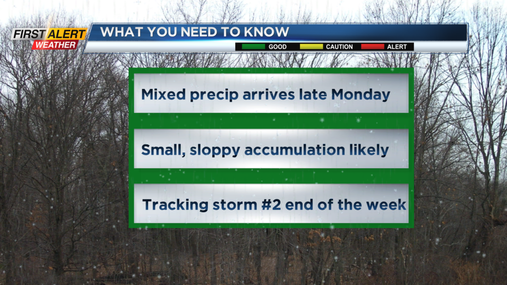
ROCHESTER, N.Y. – A weakening low-pressure system will be moving across the central great lakes on Monday and Tuesday. This will spread wet snow into Rochester on Monday afternoon and eventually some mixed precipitation for Monday night. Then a second storm looks to arrive just south of Rochester for the end of the week. This will also bring a good opportunity for snowfall as we head into the first days of the month of March.
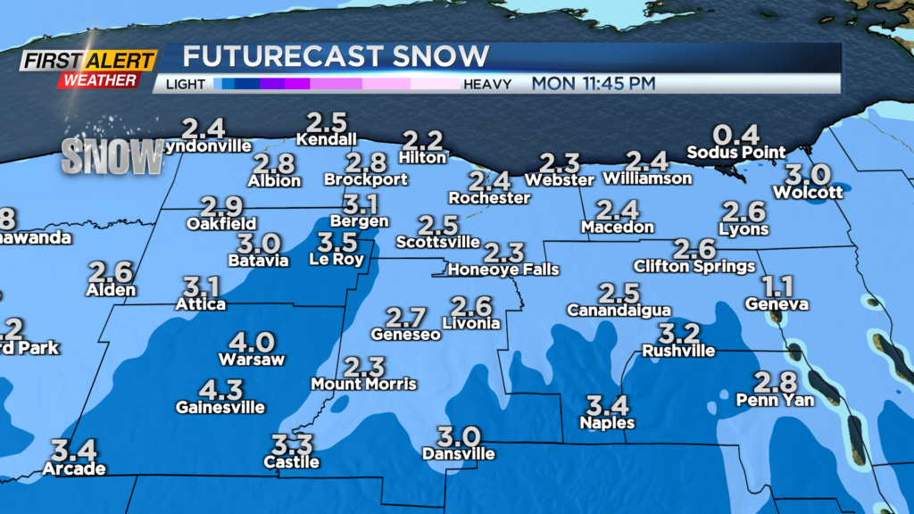
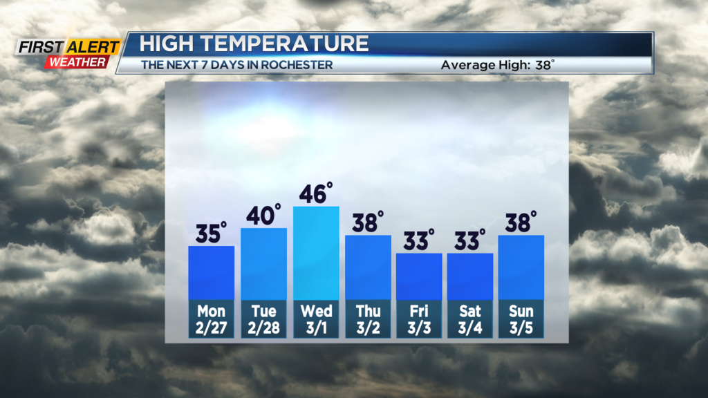
The weekend will finish with some calmer weather. Tonight, the winds will diminish with mainly dry conditions. The temperature will fall into the middle 20s. Monday the skies could brighten early, but it will be cloudy for most of the day. Wet snow will arrive by the middle to late afternoon. No accumulation is expected at first, but there could be some poor visibility with an inch or two on the ground for the Monday evening commute. Monday night there will be a change to a messy wintry mix of snow, sleet, and rain. Total snowfall will be in the range of 2 to 4 inches with the highest totals east of Genesee Valley. The temperature will be in the lower 30s, but the temperature will begin to rise overnight. Tuesday you can expect a rain or wet snow shower and the gusty winds will return for the afternoon. The high temperature on Tuesday will be near 40 degrees.
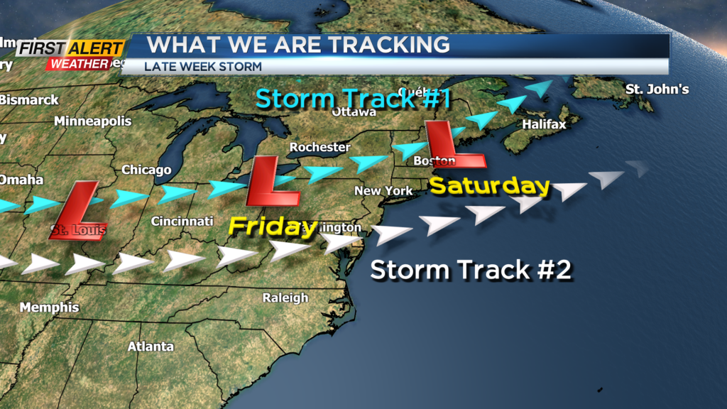
The weather will be uneventful for Thursday, but our second storm arrives on Friday. There is still a lot of uncertainty on the timing and amounts of precipitation, but there is the opportunity for significant snow and sleet throughout the day on Friday. At this time, the News 10NBC First Alert meteorologists have not issued a yellow alert, but we will continue to monitor the data for any change.
Stay tuned to News 10NBC First Alert weather for updates on the forecast.