First Alert Forecast: A damp and dreary start to 2023
[anvplayer video=”5155352″ station=”998131″]
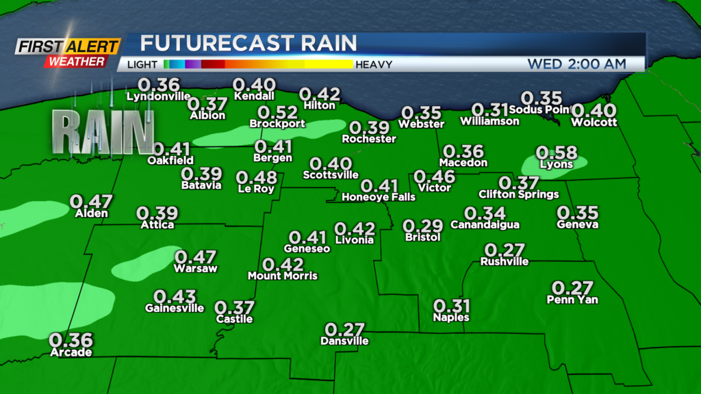
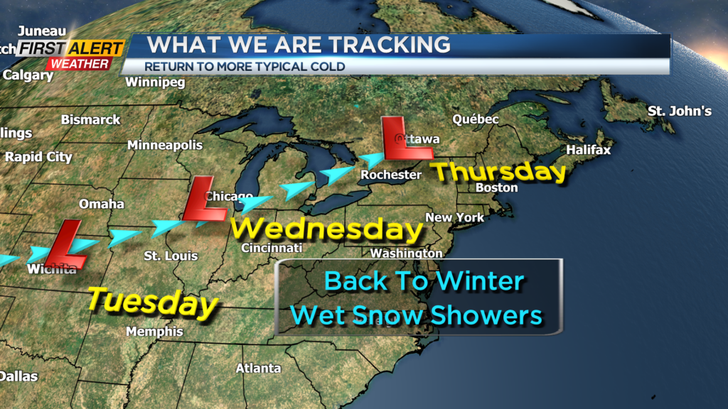
ROCHESTER, N.Y. – At times today Western New York had a chilly, light rainfall. Most of the day the temperature readings were near 40 degrees. Over the next 48 hours a storm system will be pushing into the Upper Great Lakes, which will bring a more substantial rainfall to Rochester. Latest forecast models area showing more than a half inch of rain likely for Tuesday. As the storm moves east, it will bring a return to much colder weather for the remainder of the week.
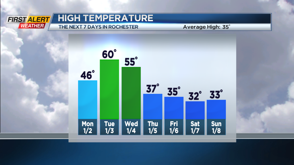
Tonight look for the chance of a few light showers or sprinkles for the evening with most of the wet weather then coming to an end during the overnight. The low temperature will be near 37 degrees. Monday should be mainly dry with the skies brightening for the afternoon. The high temperature will be in the middle 40s. Tuesday the News 10NBC First Alert meteorologists expect a steady rain at times. It will be very mild for January with the high temperature within a few degrees of 60. Passing rain showers will be likely for Wednesday with the temperature starting in the mid-50s. However, the temperature is expected to begin to fall for the afternoon. This will usher in a much colder trend for the remainder of the week.
Thursday and Friday it is back to a more seasonable chill with both days in the middle 30s. There will be occasional flurries and wet snow showers. At this time, Rochester should find little or no accumulation.
Stay tuned to News 10NBC First Alert weather for any updates in the forecast.