First Alert Forecast: A dramatic change is coming for Western New York
[anvplayer video=”5196697″ station=”998131″]
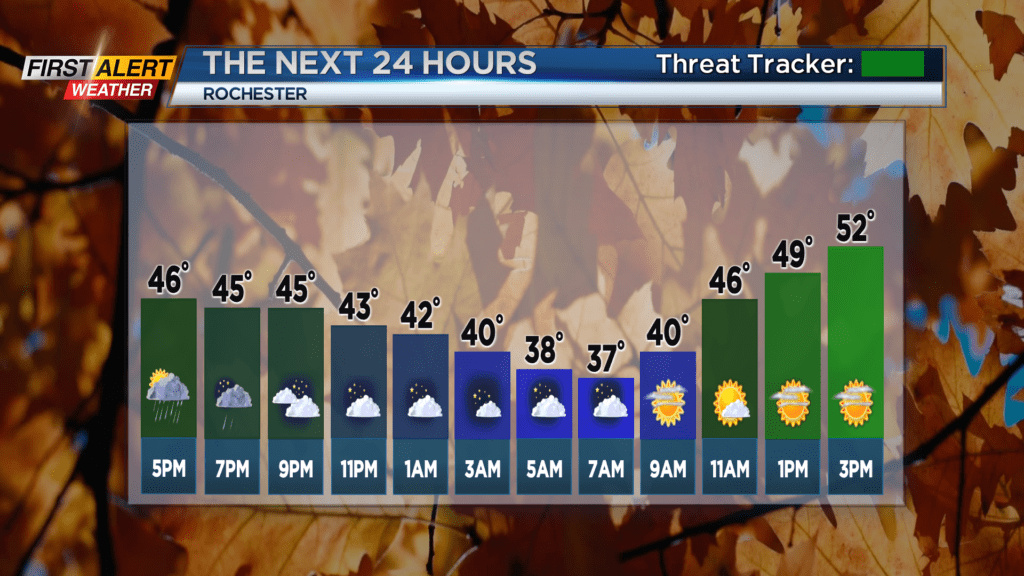
ROCHESTER, N.Y. – Sunday was likely one of the coldest days so far this season for Rochester. Most of this Sunday was spent in the 40s with occasional light showers and sprinkles. You must look back to last May for the last time the temperature stayed in the 40s. However, a large high-pressure system will be moving across the great lakes which will serve to bring in drier air and eventually much warmer temperatures.
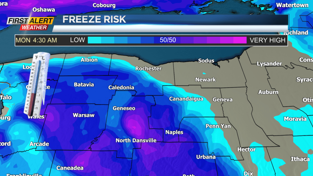
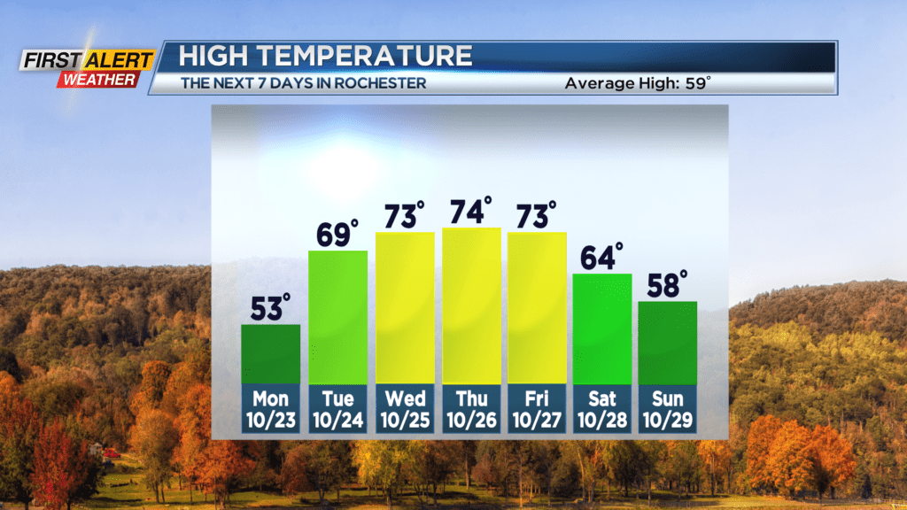
Sunday night, look for any lingering showers that are located east of Rochester to come to an end. Then partial clearing is expected later Sunday night. It will turn very chilly during the early morning hours as the lakeshore and the city will fall into the lower 40s, but the rural areas south of Rochester will fall into the lower 30s. This will likely be the first freeze of the season for some communities. Monday will bring much more sunshine and less wind. After a chilly start the mercury will rise into the lower 50s. Tuesday will bring partial sunshine and it will turn much warmer with the temperature rising into the upper 60s. The warmth will likely continue thorough Friday with just a few spotty showers from time to time.
Stay tuned to News 10NBC First Alert weather for updates on the forecast.