First Alert Forecast: A Few Showers Return for Early Columbus Day
[anvplayer video=”5140571″ station=”998131″]
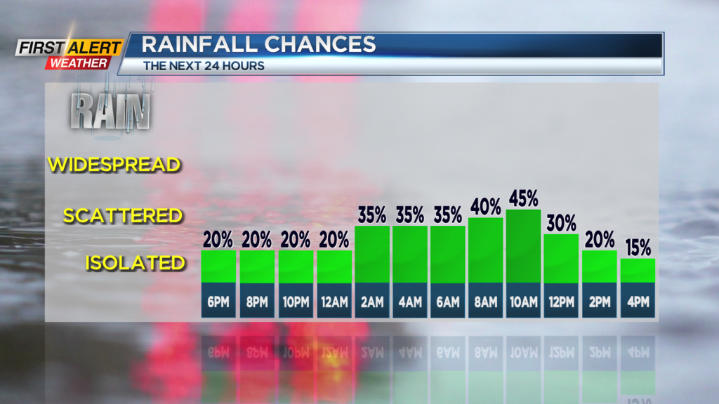
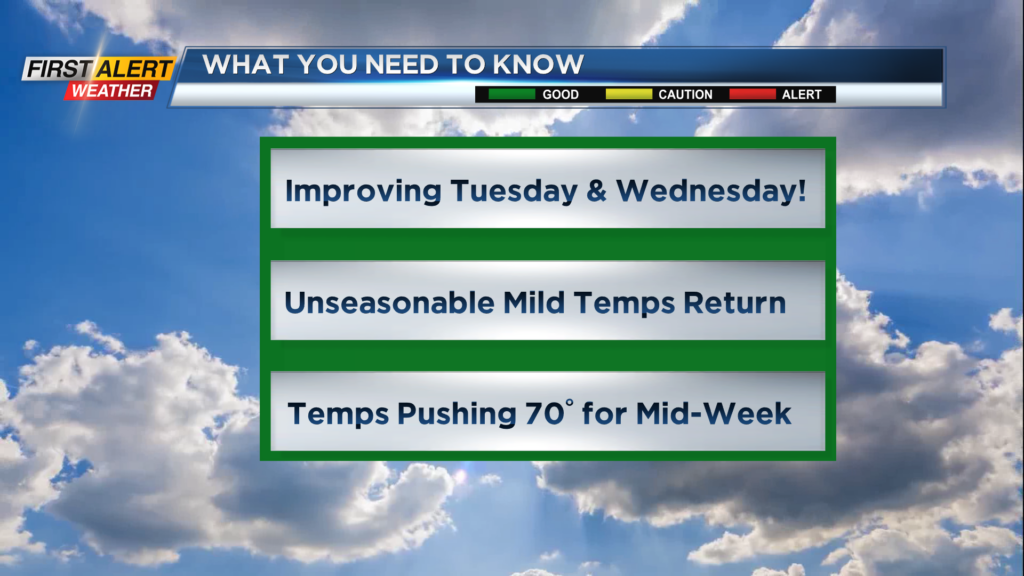
ROCHESTER, N.Y. – A cold front is set to slowly cross Western New York this evening and this will eventually bring a few light showers during the morning for Columbus Day. However, this will not be a wash-out as drier air from a building high pressure system will overspread the area for Monday afternoon. Looking beyond the holiday, a more southwesterly wind will return by Tuesday which promises to bring much warmer weather for mid-week.
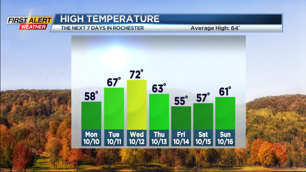
Tonight look for cloudy skies with the small chance of a few sprinkles for the evening. Then a better chance of light showers developing just after midnight. The temperature will fall into the lower to middle 40s. Light showers will be off and on for Columbus day morning, but by the afternoon should bring breaks of sunshine. The high temperature is expected to be in the upper 50s. Tuesday should be a fine autumn day with bright sunshine and warmer weather. The mercury will rise into the upper 60s. The warmth will keep coming for Wednesday and it should be the warmest day of the week. The high temperature will rise into the low 70s. However, the sunshine will begin to fade for Wednesday afternoon with more clouds returning and the chance of a late day shower possible.
The next cold front approaches later Wednesday and Thursday. Rain will be developing Wednesday night with the wet weather continuing into Thursday. As a result, the temperature will falling from the lower 60s into the 50s and eventually into the 40s late in the day. Friday skies may brighten at times, but a lake showers will be possible with the temperature remaining in the low to mid-50s.
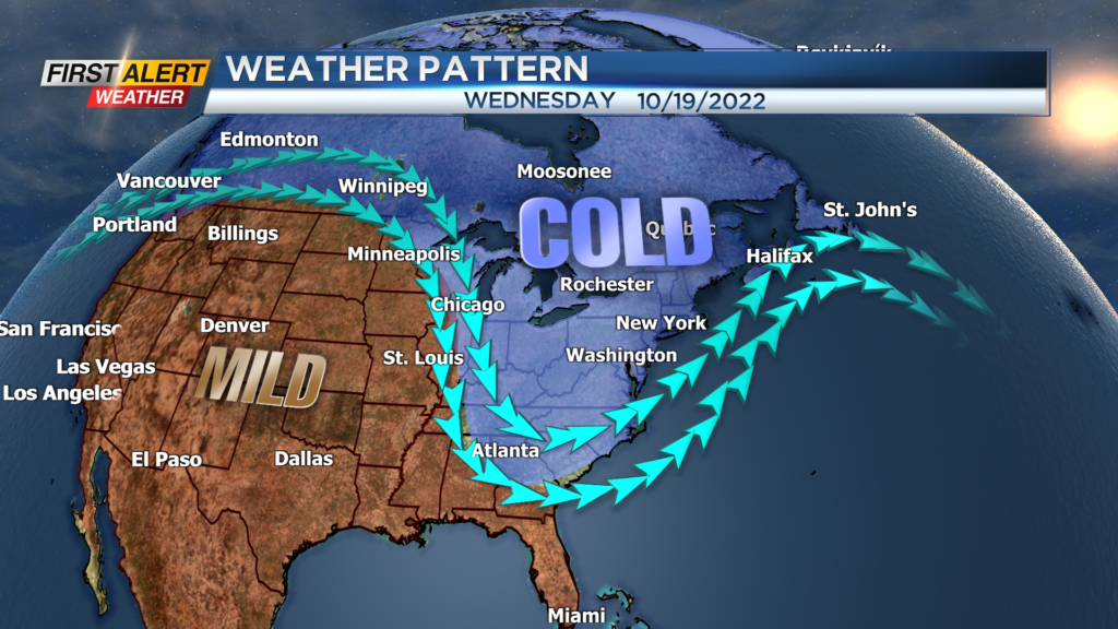
This weekend looks to be seasonably cool, but then early indications are that the weather pattern will take a dramatic turn for early next week. It is possible that some of the coldest weather of the season arrives next Tuesday.
Stay tuned to News 10NBC First Alert for updates on the forecast.