First Alert Forecast: A gusty, cold and snowy day to finish the winter season
[anvplayer video=”5168492″ station=”998131″]
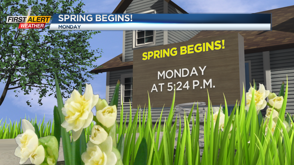
ROCHESTER, N.Y. – The last full day of the winter season ends with lake effect snow showers. Officially, the Rochester Airport measured 1.6 inches of snow for the day, but for the season snowfall is still running almost 45 inches below normal. Looking ahead to the coming week, warmer weather is on the way for Western New York. That is good timing considering the official start of the spring season is Monday with an arrival time of the vernal equinox set for 5:24 p.m.
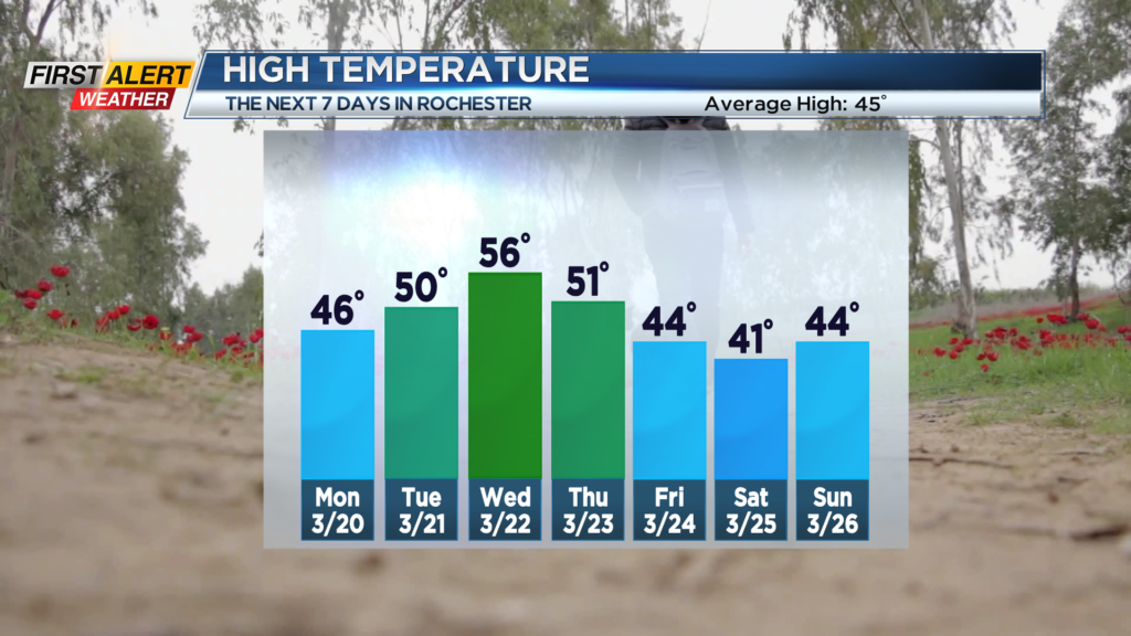
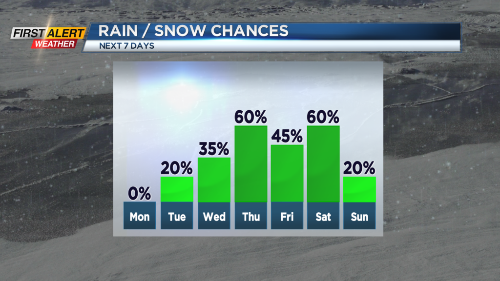
Sunday night, lake snow flurries will come to an end with clearing skies Sunday night. The winds will diminish, but it will be another cold night with low temperature in the upper 20s. Monday will bring plenty of bright sunshine. It will be breezy at times, but not as chilly with the high temperature in the middle 40s. Tuesday the temperature will continue to rise with the mercury reaching near 50 degrees. It should be dry for Tuesday, but mostly cloudy skies is expected. Wednesday rain showers are possible for the afternoon, but again it will be rather mild with the high temperature in the middle 50s. Look for a few more rain showers heading into Thursday with the high temperature near 50 degrees.
Stay tuned to News 10 NBC Frist Alert weather for any updates on the forecast.