First Alert Forecast: Already tracking the next round of rain
[anvplayer video=”5188619″ station=”998131″]
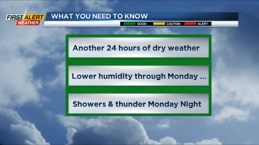
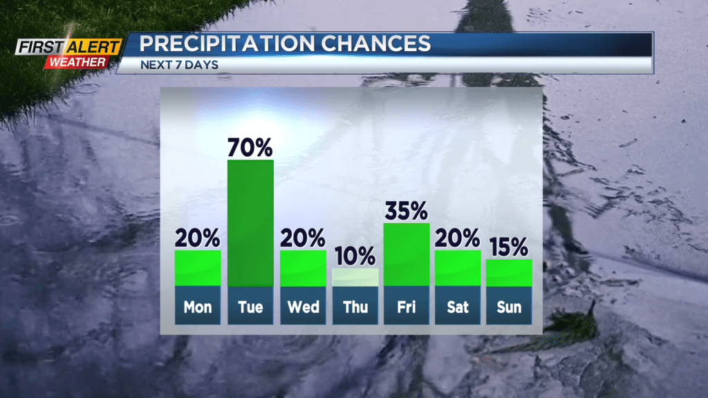
ROCHESTER, N.Y. – As they say it has been “Chamber of Commerce” type day to finish the weekend. High-pressure has brought Western New York more comfortable temperatures and lower humidity. This pleasant weather is likely to continue for another 24 hours which will make for a nice start to the work week. However, another area of low-pressure will rotate just south of Rochester and produce more showers and thunder for Monday night and Tuesday.
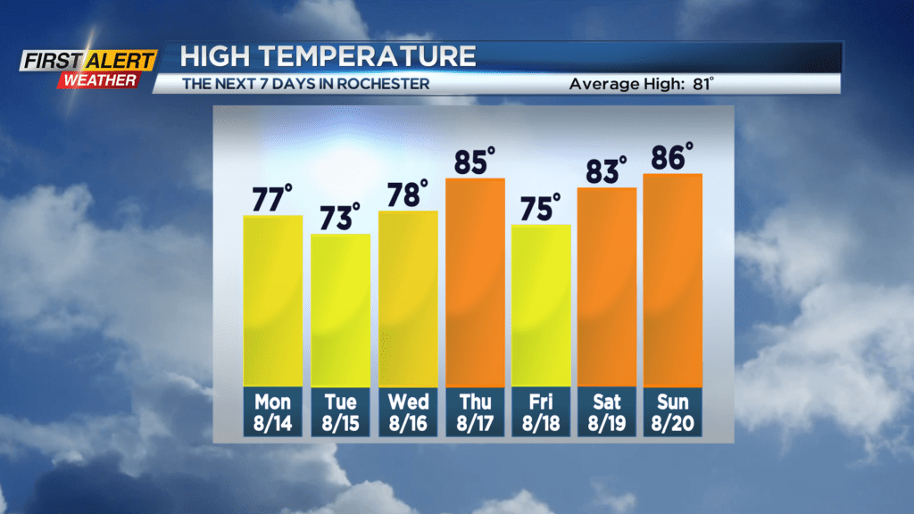
Sunday night look for patchy clouds and a low temperature within a few degrees of 60. Monday will be dry with partial sunshine and lower humidity. The high temperature in the upper 70s. Monday night the clouds roll-in with showers developing and possibly a few thunderstorms later in the night. The temperature in the lower 60s. Tuesday you can expect it to be mainly cloudy with occasional showers. A lack of sunshine with a northerly wind means it will be unseasonably cool for August as the temperature will struggle to reach the lower 70s. Sunshine and more seasonable weather will return by Wednesday and Thursday.
Stay tuned to News 10 NBC First Alert weather for updates on the forecast.