First Alert Forecast: Could it be the first hint of winter?
[anvplayer video=”5142112″ station=”998131″]
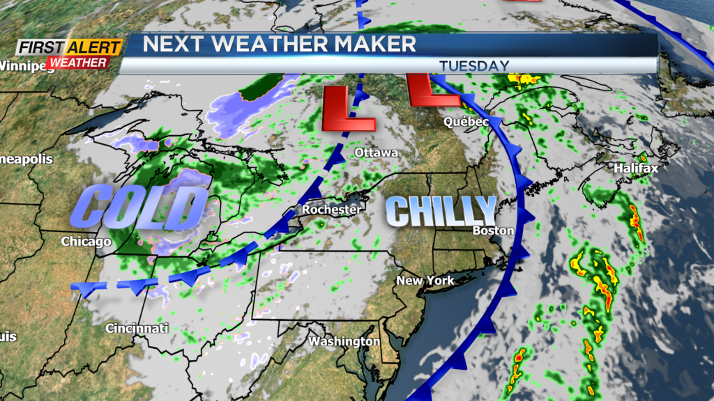
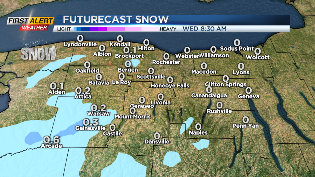
ROCHESTER, N.Y. – After some pretty good weather this weekend, a deep trough of low pressure will rotate across Western New York. This is a slow moving weather system that will have a major impact on the temperature, wind and precipitation for a significant portion of the week. In addition, it will cold enough for a response from the Great Lakes. This will be the first real lake effect event off Lake Erie with the concentration of precipitation west and southwest of Rochester.
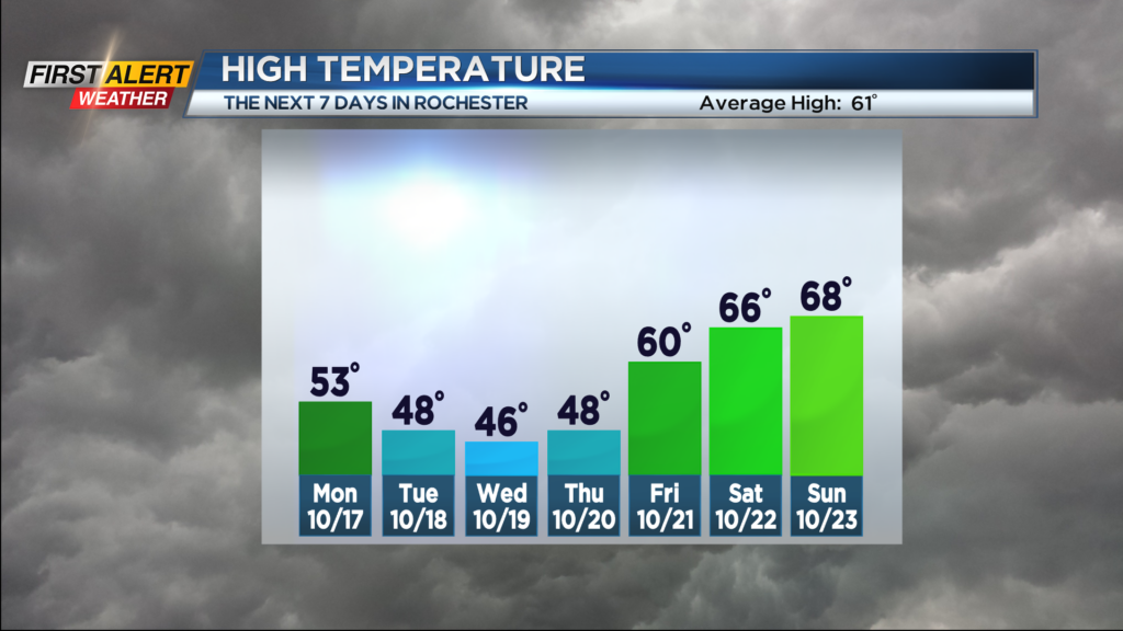
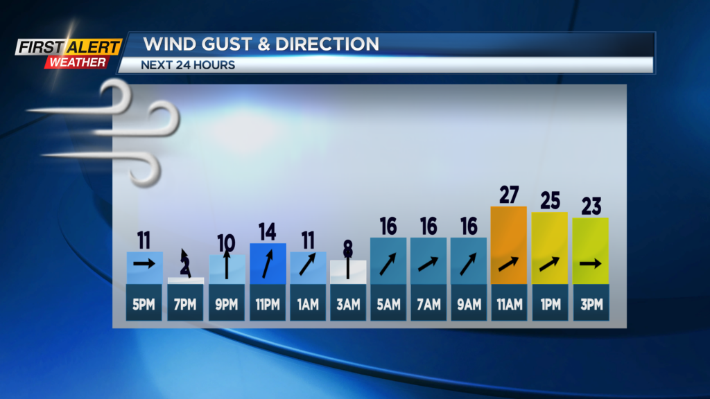
Tonight look for increasing clouds with the chance of a rain shower after midnight. The low temperature will be in the lower 40s. Monday the skies may brighten from time to time, but rain showers will be likely especially west of Rochester. Expect a gusty wind as the temperature will start in the lower 50s, but will fall into the 40s by the end of the day. Tuesday will bring the coldest weather of the season as the mercury will remain in the 40s. Look for a changeable day with breaks of sun, a passing rain shower, but the hills south of Rochester may see a few wet flurries. The chill will continue into Wednesday and Thursday with more rain showers for most areas and wet flurries in the southern tier.
It appears we will finally start to turn the corner by Friday and Saturday. Look for more sunshine for both days and the temperature warming back into the 60s.
Stay tuned to News 10NBC First Alert for updates on the forecast.