First Alert Forecast: Drier weather for start of the week
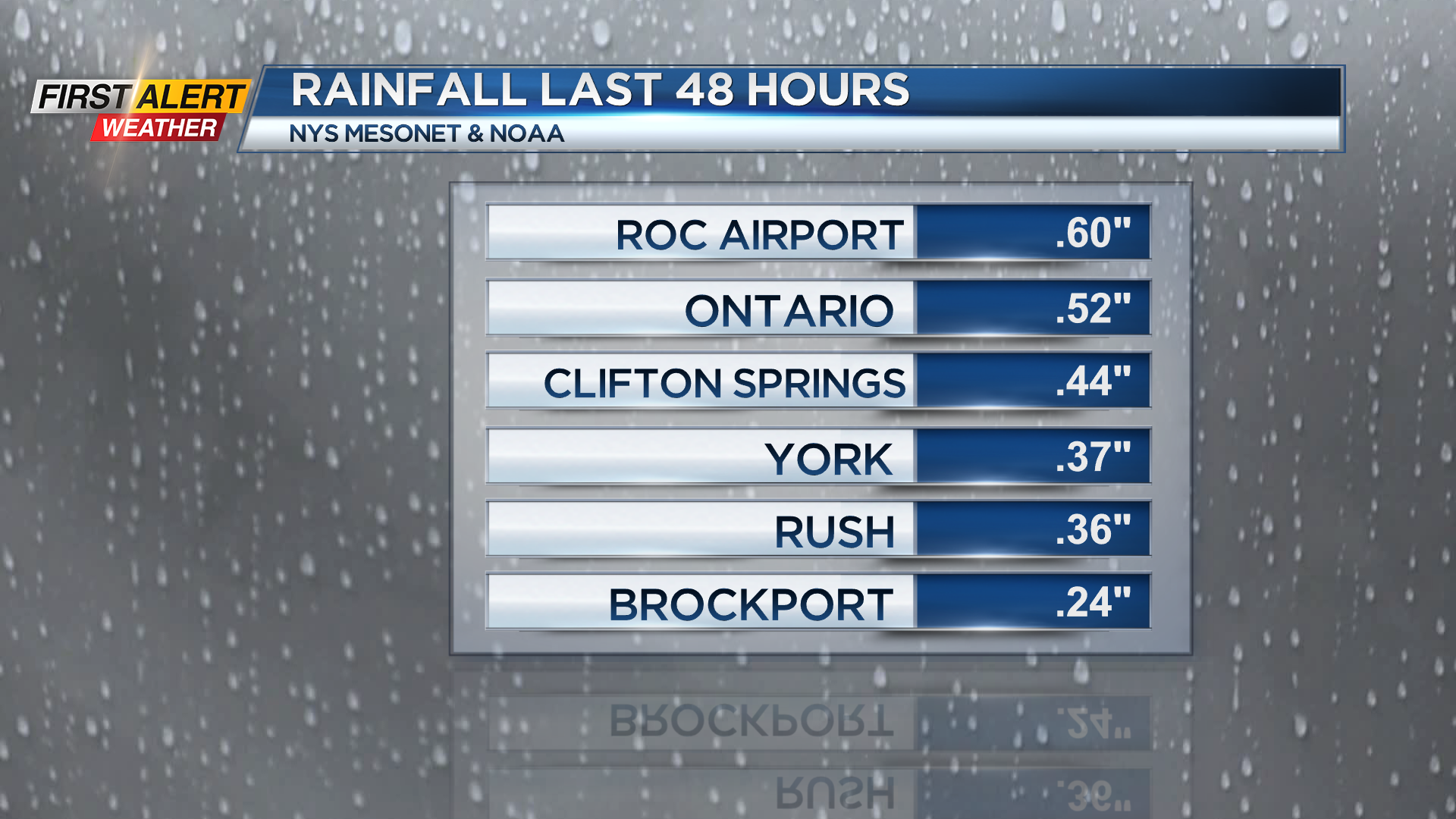


ROCHESTER, N.Y. – There were plenty of showers to finish this weekend with most communities seeing between a quarter and a half inch of rainfall. However, Western New York is not quite finished with the wet weather as we are still waiting for a cold front to slowly cross the area for this Sunday evening. Another shower or thundershower is possible, but as the front passes around midnight, drier air will spread across the Rochester area with the promise of a pleasant start for the work week.
Sunday night, look for a brief shower or thundershower around the middle of Sunday evening. The temperature will fall into the lower 50s. Monday will feature partial sunshine with the temperature rising into the upper 60s, but it will be cooler within a few miles of Lake Ontario. Tuesday brings more sunshine with a high temperature within a few degrees of 70, but again it will be a little cooler near Lake Ontario. The next weather system will be approaching by the middle of the week which means a return to occasional showers and thundershowers for Wednesday and Thursday. And early indications are that there will be a few showers with much cooler temperatures for the start of the Lilac Festival on Friday.
Stay tuned to News 10 NBC First Alert weather for updates on the forecast.