First Alert Forecast: Gusty Winds Move In And Quickly Move Out
[anvplayer video=”5151054″ station=”998131″]
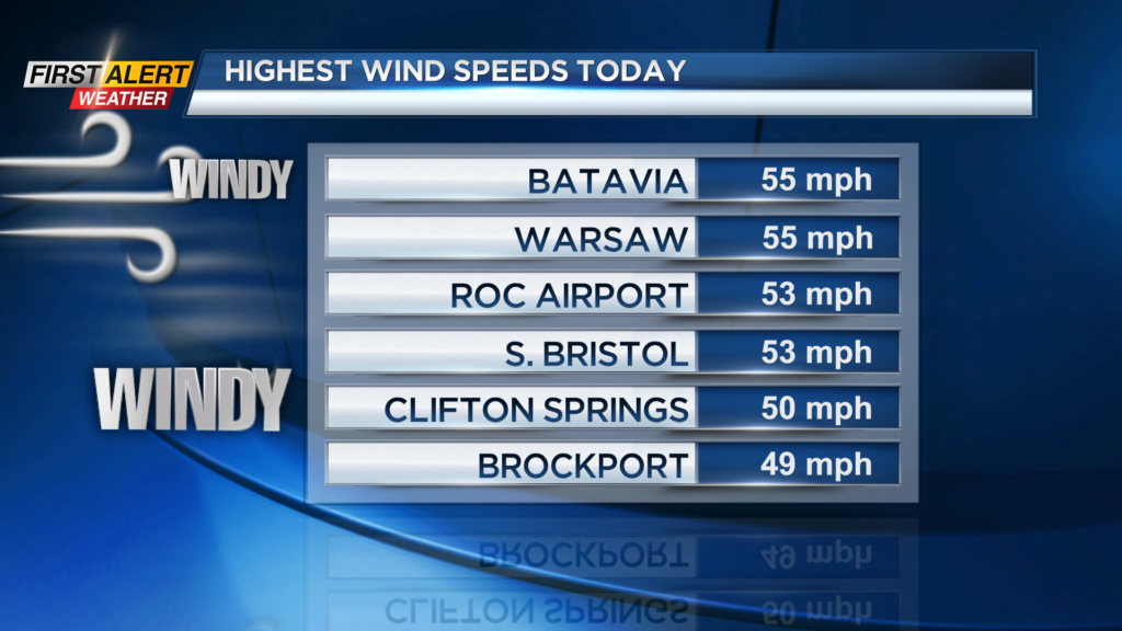
ROCHESTER, N.Y. – A strong cold front has crossed Western New York today and produced a rapid change in the temperature along with very gusty winds. Top wind speeds were running between 50 and 55 miles per hour. As a result, there were some reports of isolated downed trees and power outages, but no significant damage was noted for the Rochester area. As high pressure continues to move in to the northeast the wind speeds will continue to taper off. The yellow alert issued by the News10NBC First Alert meteorologists has been discontinued.
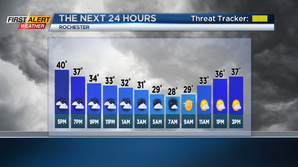
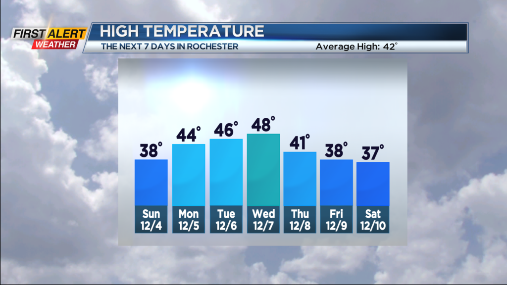
Tonight look for most cloudy skies with just a few lake flurries developing in Wayne County. It will be less windy with the low temperature in the upper 20s. Sunday is expected to be a much calmer day with partial sunshine. It will be chilly with the high temperature only in the upper 30s. Monday looks to be dry with plenty of sun for the morning, then clouds increasing for the afternoon. The mercury will rise into the middle 40s.
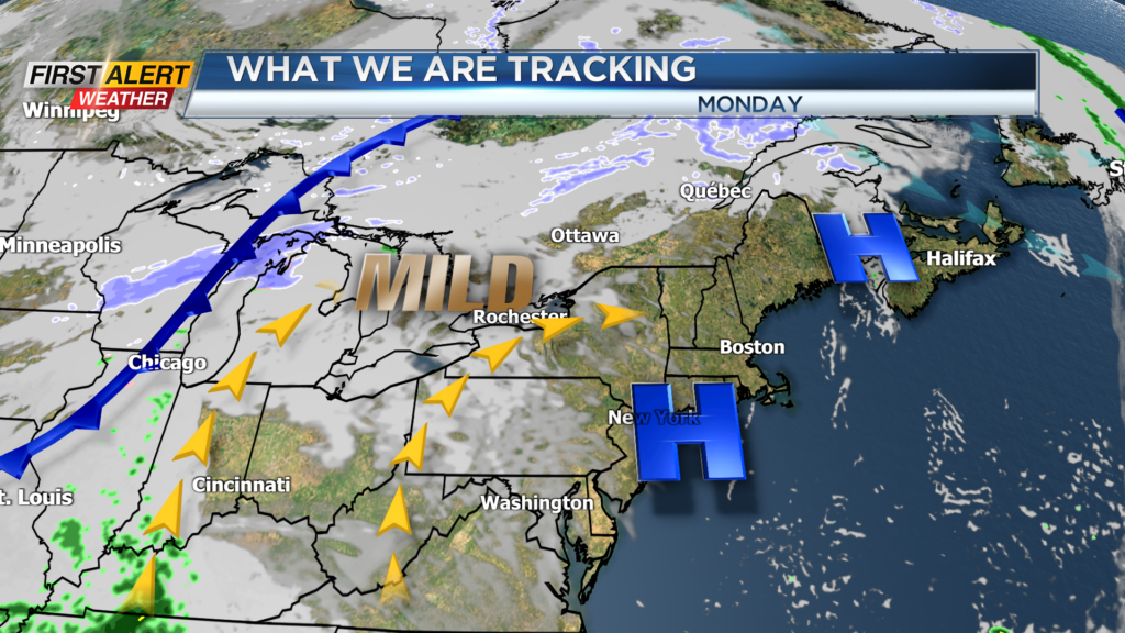
Tuesday and Wednesday a cold front will be approaching the great lakes. The temperature will remain on the mild side with the temperature in the middle to upper 40s. However, there is the chance of a few rain showers through the middle of the week.
Stay tuned to News 10 NBC First Alert forecast of any updates.