First Alert Forecast: Gusty winds will diminish Tuesday evening
[anvplayer video=”5166323″ station=”998131″]
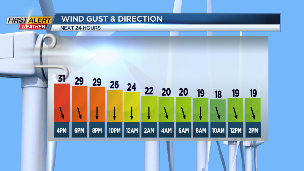
ROCHESTER, N.Y. – The sunshine was nice on Tuesday, but the gusty winds did produce a bit of a wind chill. At times, the wind was gusting to near 40 miles per hour, which brought a wind chill in the lower 20s. However, the wind will diminish as we go through the overnight. Looking ahead to the next couple of days, the overriding theme will be below normal temperatures with no sign of spring-like conditions for at least the next 10 days.
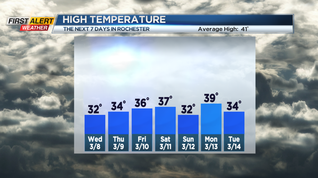
Tuesday, look for less wind, but more clouds and the chance of snow flurries developing. The temperature will fall into the middle to upper 20s. Wednesday and Thursday will feature mainly gray skies with occasional flurries. As mentioned, it will be rather chilly with the temperatures mainly in the low 30s. Typically, the high temperature is in the lower 40s for this time of the year.
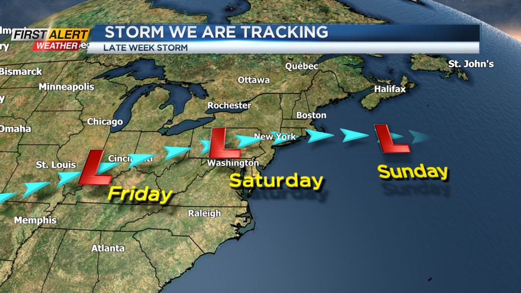
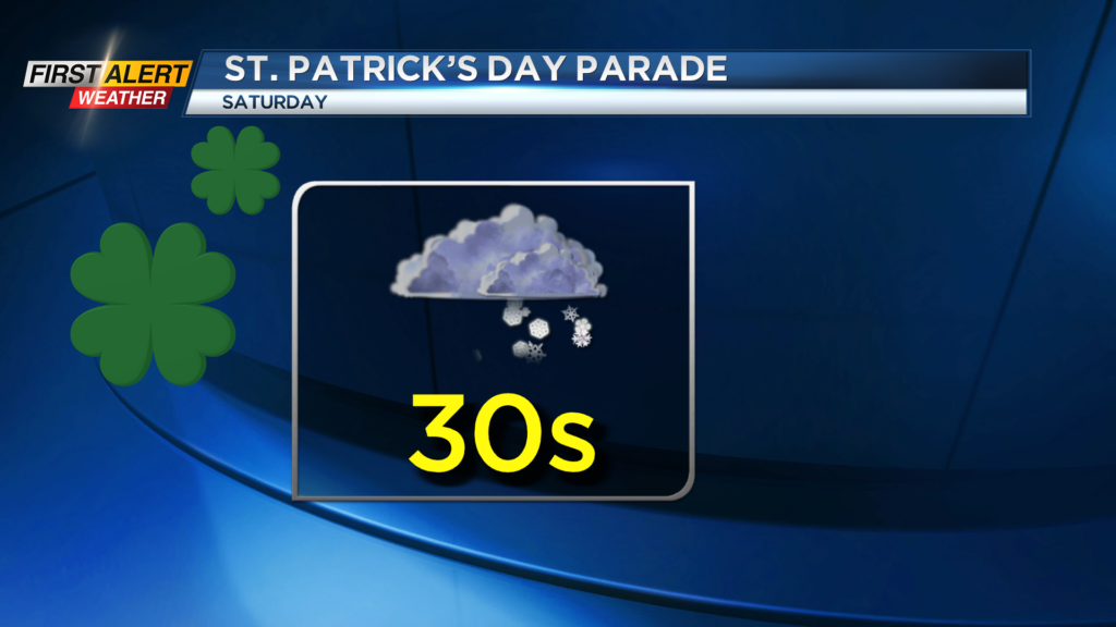
Friday the News 10NBC First Alert meteorologists are tracking a storm that looks to move south of Rochester across the Ohio Valley into Pennsylvania for Friday and Saturday. There is still a great deal of uncertainty on the exact track of the storm and as a result the impact on precipitation, but travel could get tricky for Friday night and early Saturday. In addition, we are monitoring the storm for the St. Patrick’s parade for Saturday. Right now it appears that people attending parades should dress for winter conditions.
Stay Tuned to News 10NBC First Alert Weather for updates on the forecast.