First Alert Forecast: Lake Erie Makes a Big Deposit of Snow
[anvplayer video=”5153498″ station=”998131″]
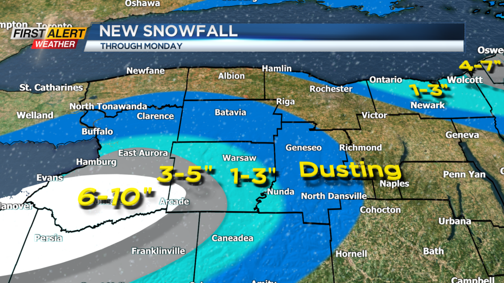
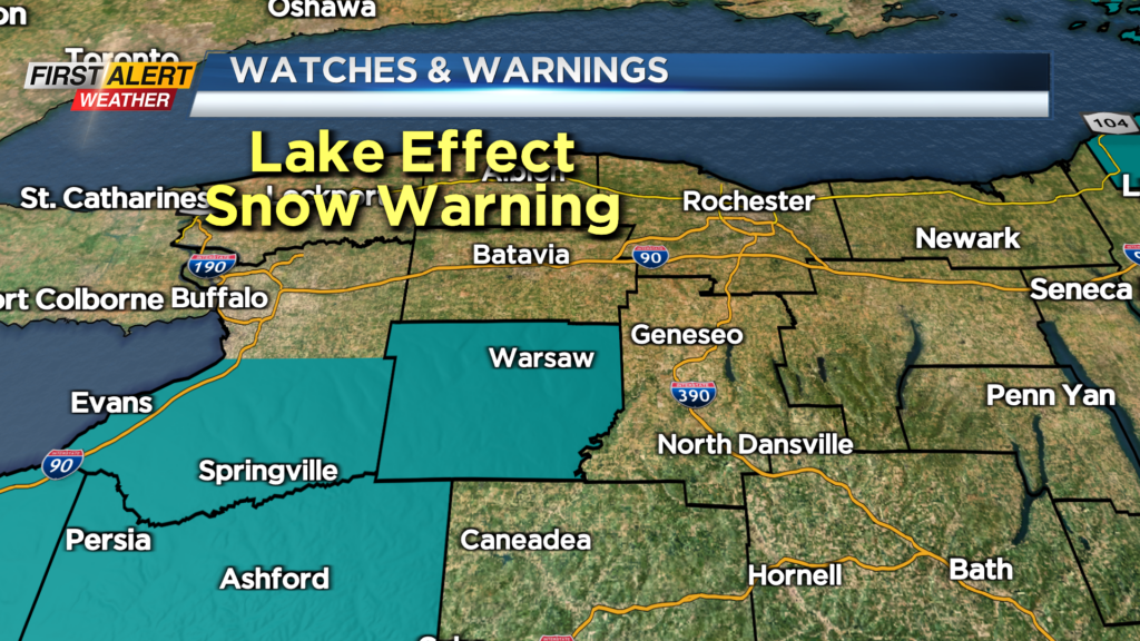
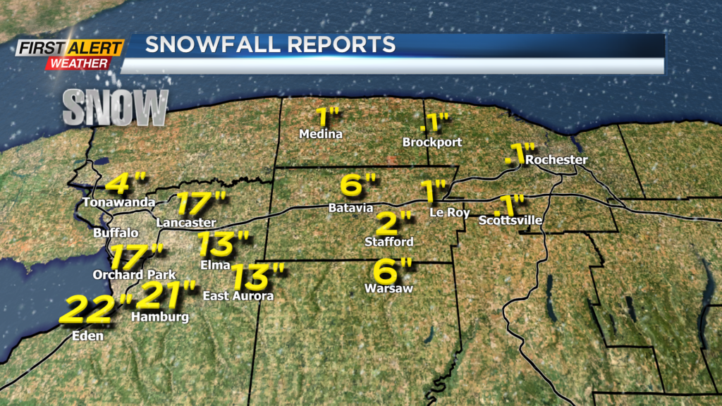
ROCHESTER, N.Y. – Portions of southern Erie County measured between 1 and 2 feet of snowfall during the last 24 hours. This compared to the Rochester area which generally saw less than an inch of accumulation. This Lake Erie snow squall will likely bring another 6 to 10 inches in southern Erie County and 2 to 5 inches into portions of Wyoming County. A lake effect snow warning remains in effect for communities south of Buffalo.
Tonight all of Western New York will find occasional flurries or a passing snow shower. Most of the Rochester area can expect little or no accumulation through the overnight. The low temperature will be in the upper 20s. Monday’s weather should be largely uneventful with mostly cloudy skies. Again, look for passing flurries – especially later in the afternoon. The temperature will only rise into the lower 30s. Monday evening there could be a better chance of Lake Ontario snow showers along Route 104, mainly in Wayne County with 1 to 3 inches possible by morning. The temperature will fall into the middle 20s.
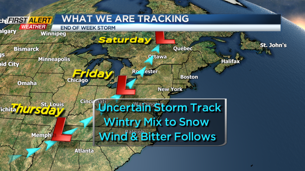
Tuesday and Wednesday should bring mainly calm weather with breaks of sunshine. Both days will feature a temperatures in the middle 30s. Then a potential storm could be developing through the Tennessee and Ohio Valley by Thursday, Friday and Saturday. Still a great deal of uncertainty to the storm track, timing and intensity of the storm. However, a combination of mixed precipitation changing to snow will be a possibility heading into the weekend. In addition, strong winds will be possible for Christmas Eve with bitter cold likely for Christmas day.
Stay tuned to News 10NBC First Alert weather for updates to the forecast.