First Alert Forecast: Light rain today, but could it be heavier rain for Monday?
[anvplayer video=”5134338″ station=”998131″]
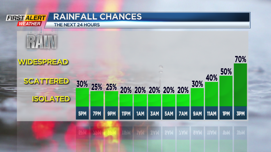
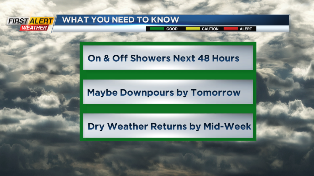
ROCHESTER, N.Y. – It may have seemed like a lot of rain for today, but in reality rainfall measurements were only at a tenth of inch or less. This is another slow moving weather system that will continue to produce periodic showers over the next 48 hours for Western New York. The News 10NBC First Alert meteorologists are not expect significantly drier weather until the middle of the week.
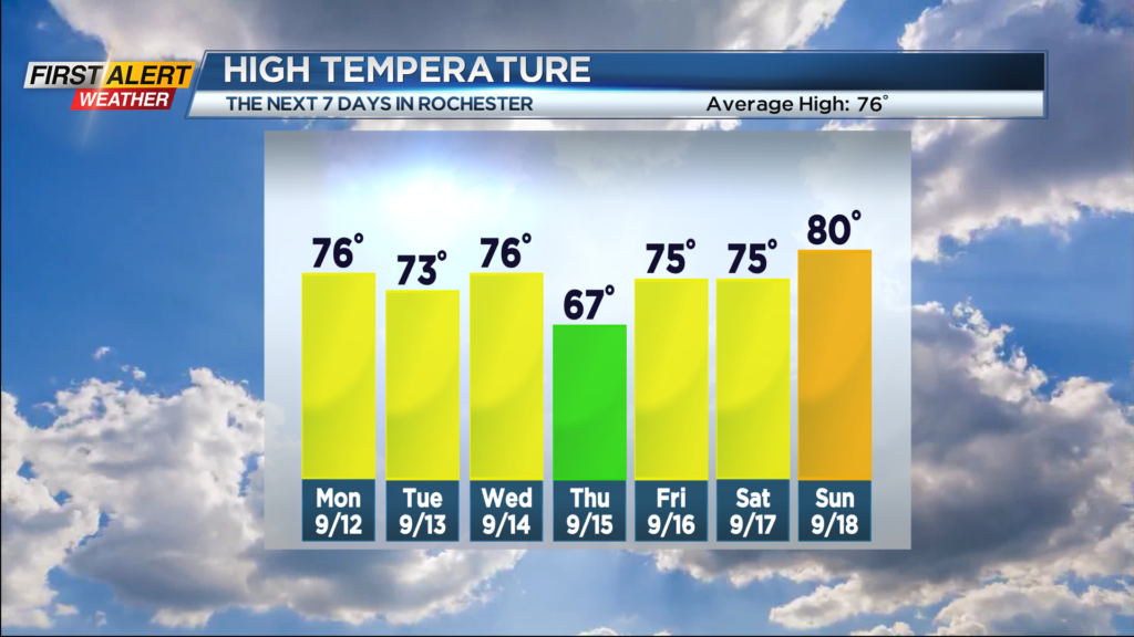
Tonight will continue to be damp with occasional light sprinkles and drizzle. The temperature will only fall into the lower 60s. Monday skies may brighten at times, but more showers are expected with the chance of a thunderstorm for the afternoon. It is likely that any storms tomorrow will produce downpours from time to time. At this point, severe weather is not expected, but we will continue to track the location and intensity of these storms. The high temperature will be in the middle 70s. Tuesday will be a changeable day with breaks of sunshine, a passing shower and maybe another thundershower by the afternoon. The high temperature will be in the low 70s.
We do expect Rochester will turn the corner towards drier weather for Wednesday. The day should bring much more sunshine with the humidity falling later in the day. The high temperature will be in the mid-70s. Another cold front passes us for Thursday with some of the coolest weather of the season expected. Temperatures will remain in the 60s most of the day and then fall to within a few degrees of 50 for Thursday night.
Stay tuned to News 10NBC First Alert for any updates on the forecast.