First Alert Forecast: Likely The Coldest Christmas in Over 20 Years for Rochester
[anvplayer video=”5154402″ station=”998131″]
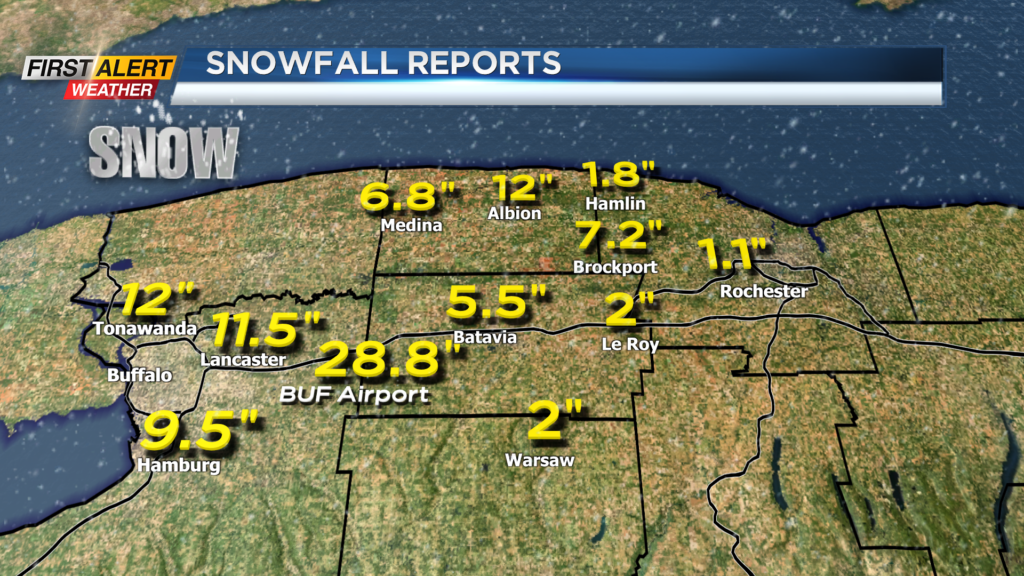
ROCHESTER, N.Y. – An intense winter storm continues to bring very harsh winter conditions for most of the eastern United States. In Western New York portions of the Buffalo area have measured between 1 to 2 feet of snow as a result of blizzard-like squalls coming off Lake Erie. This heavy, wind-driven snow reached as far east as Brockport where over 7 inches has been measured over the last 36 hours. Even if you did not see the heavy snow, bitter cold and high winds have been unrelenting since Friday. At times, the wind chill factor has been reaching dangerous levels at -10 to -20 degrees.
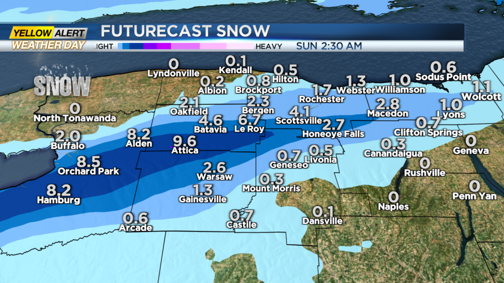
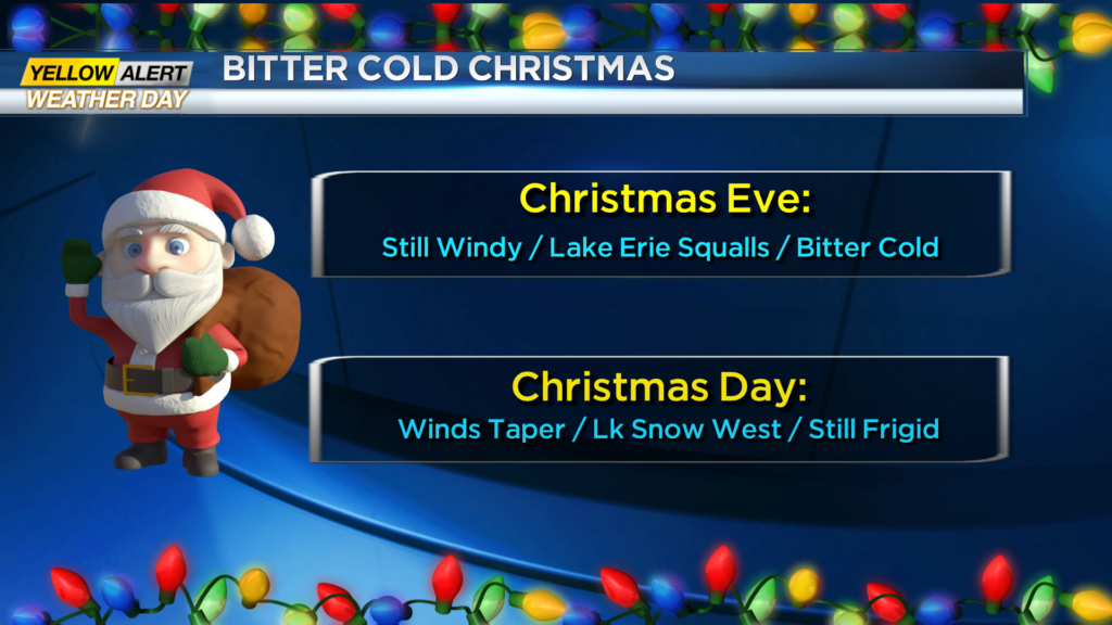
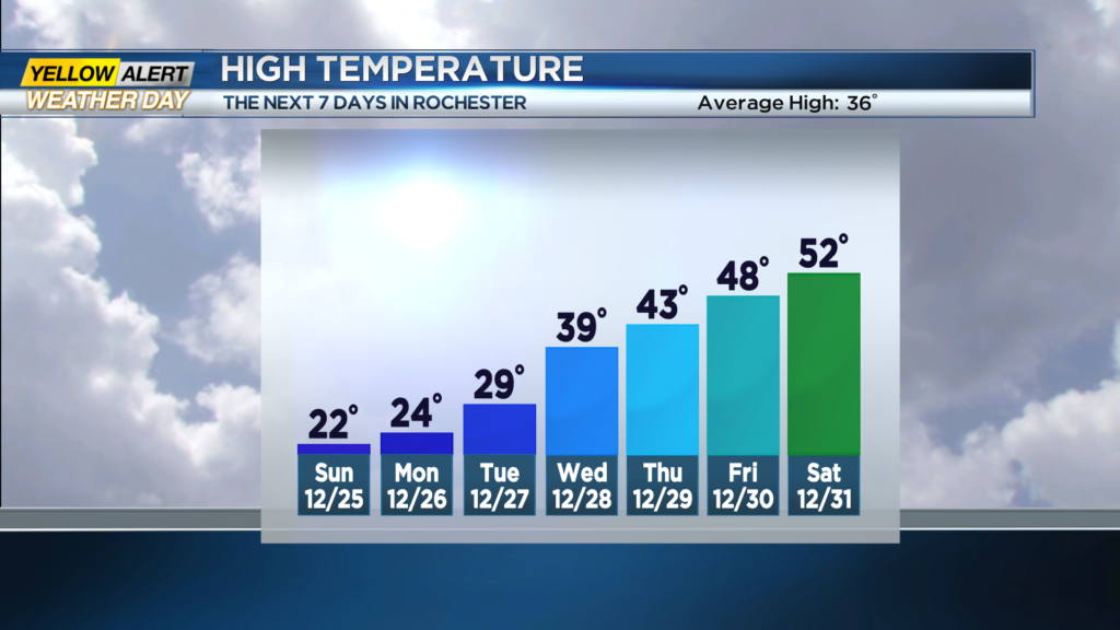
Lake Erie squalls will continue tonight south and west of Rochester. As this intense squall begins for move slowly drift south, the Buffalo area could see another foot or more of snow. Some of that snow could reach the Rochester suburbs (especially to the west) where 1 to 4 inches of accumulation is possible. The highest winds speed have come to an end, but some gusts may still reach near 40 mph and with the temperature in the low teens the wind chill staying in the subzero range. The News 10NBC First Alert meteorologists will continue with a yellow alert for tonight due to the extreme conditions. Christmas day the winds will slow diminish, but the bitter cold weather will continue as temperature readings will only reaching the low 20s. This will likely be the coldest Christmas Day since 2000, more than 20 years ago. Lake snow for tomorrow will likely taper off west of Rochester.
Monday, Tuesday and Wednesday conditions will slowly moderate as the temperature climbs through the 20s and eventually reaches the upper 30s by Wednesday.