First Alert Forecast: Localized downpours for some communities
[anvplayer video=”5182787″ station=”998131″]
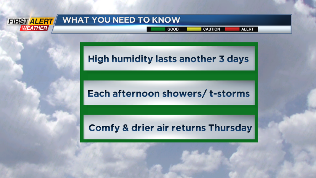
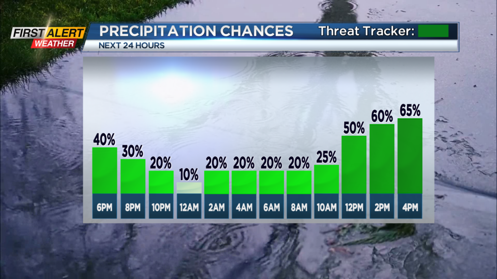
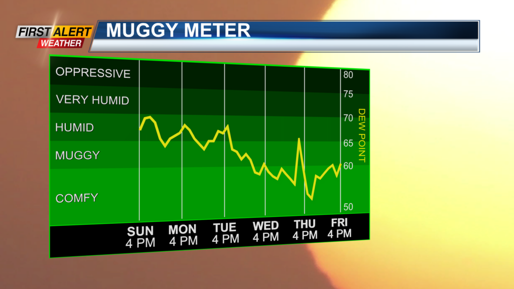
ROCHESTER, N.Y. – A very warm, tropical airmass continues over the eastern half of the United States. As a result, the humidity was close to the highest levels of the season for Western New York. The dew point was near 70 degrees, and at times all that moisture came down as spotty heavy downpours. For some communities, these slow-moving storms produced torrential rainfall. Some locations measured over an inch of rain, while others may have not gotten a drop of wet weather. The high humidity and unsettled weather will likely continue until mid-week when lower humidity returns to Rochester.
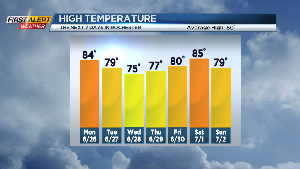
Tonight, look for the coverage of showers and thunderstorms to diminish, but still at any portion of the overnight there is the chance of a stray thundershower. It will be muggy with low temperatures in the middle 60s. Monday should bring a few breaks of sunshine for the morning, then another round of showers and thunderstorms is likely for the afternoon. The high temperature is expected to reach the lower to middle 80s. Tuesday appears to be much of the same with the greatest chance of showers and storms for the afternoon. Lots of humidity with the high temperature within a few degrees of 80. Wednesday the scattered showers should begin to taper, with the humidity beginning to fall later in the afternoon. The high temperature will be in the lower to middle 70s.
Stay tuned to News 10NBC First Alert weather for updates on the forecast.