First Alert Forecast: Looking unsettled and possibly snowy next week

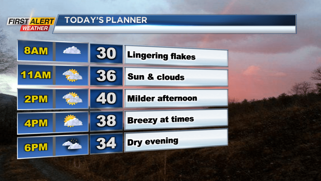
ROCHESTER, N.Y. — Waking up Saturday to another chilly start as temperatures are around the 30-degree mark once again.
Temperatures in the afternoon will be a little warmer, as they reach the 40-degree mark, but it will be breezy from time to time, making it feel a little cooler. We will also see a few flakes fly early Saturday morning, but we are generally dry with a mixture of sun and clouds expected throughout the day. This mixture of sun and clouds will continue through Saturday night before overcast skies roll in for Sunday.
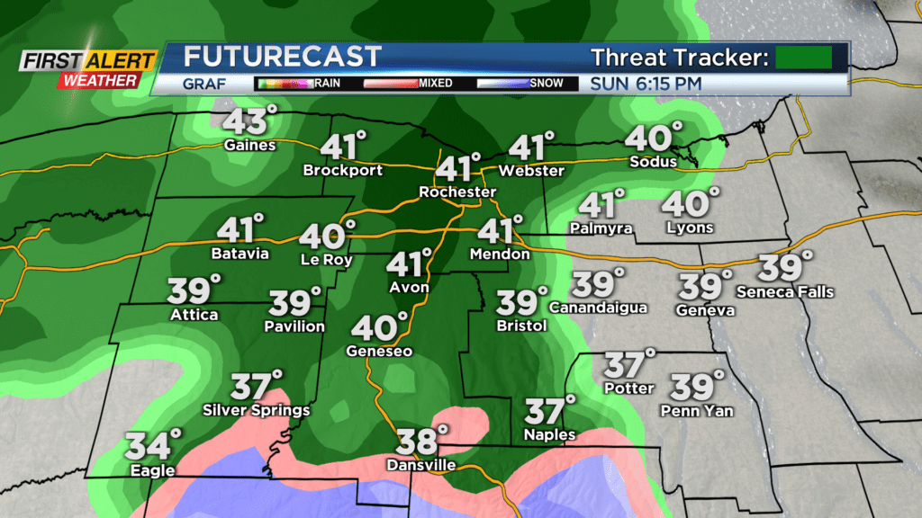
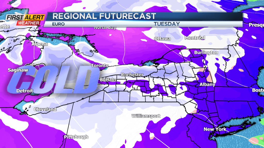
Most of Sunday will be dry, but rain showers are expected to move in during the evening hours. Scattered showers will be in the forecast through Sunday night before a cold front moves through Monday morning and transitions rain showers to snow showers. No accumulation is expected on Monday, but even colder air moves in for Tuesday and Wednesday to bring us a good chance for lake effect snow showers.
Locally we are not expecting any major impacts, but occasional snow showers will be possible with some minor to light accumulations possible, especially along Lake Ontario and east of Rochester. We will continue to monitor our lake effect snow chances, but it would be a good idea to make sure you at least have the snow brush ready to roll.
Even without the lake effect snow it is looking cold and breezy with wind chills in the 20s through much of Tuesday and Wednesday.