First Alert Forecast: Melting of snow and ice will begin Sunday
[anvplayer video=”5164742″ station=”998131″]
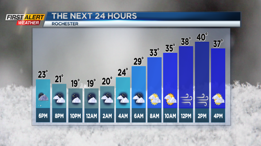
ROCHESTER, N.Y. – The frozen tundra of Western New York will continue for this Monday evening. Many areas received a fresh coating of snow which covered a layer of ice. However, a warm front will approach Rochester later tonight and that will push the temperature upwards for early Sunday. It has been several days since we felt above freezing temperatures, but that will change for Sunday.
This evening any lingering flurries will come to an end. Look for a few breaks in the cloud cover with the temperature falling into the upper teens. However, winds will switch to the south and the temperature will begin to rise towards Sunday morning. The skies may brighten at times on Sunday and it will not be as cold with the high temperature near 40 degrees. It will turn windy later in the afternoon with gusts near 35 miles per hour.
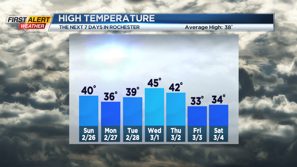
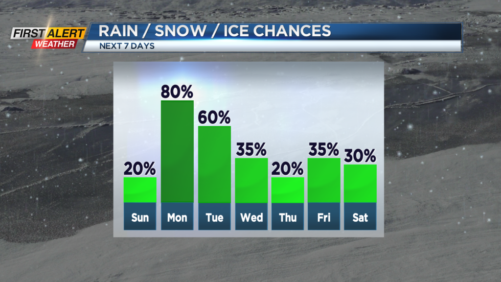
It looks like a sloppy, wintry mix of precipitation to end the month of February. Monday our next low-pressure system will be tracking across the central great lakes. This will bring a mix of rain, wet snow and possibly some sleet late Monday , Monday night and early Tuesday. The temperature will be marginal for any significant accumulation with the best chance of a small accumulation will be in the higher elevations south of Rochester. Temperatures will be mainly in the 30s.
Stay tuned to News 10NBC First Alert weather for any updates to the forecast.