First Alert Forecast: Minor amounts of lake effect snow for later tonight
[anvplayer video=”5156397″ station=”998131″]
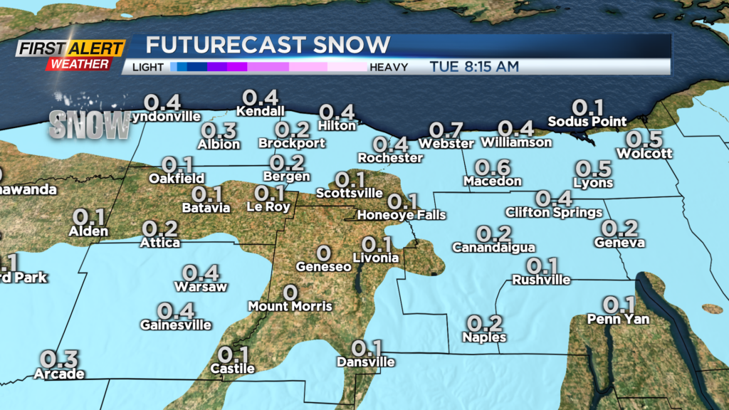
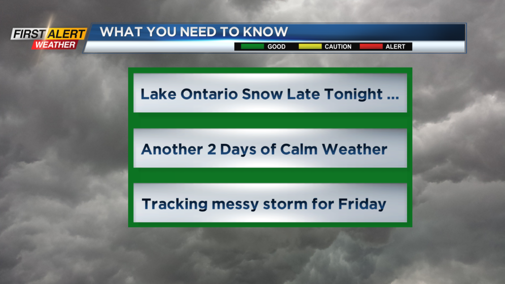
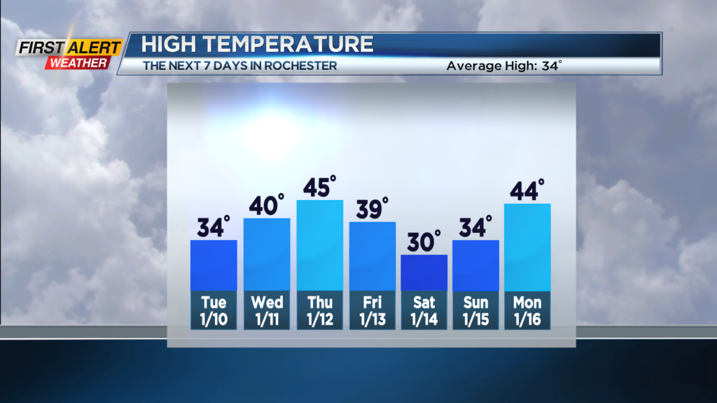
ROCHESTER, N.Y. – A cold front will cross Western New York during the overnight hours. This will reinforce the chilly temperatures, but will also produce some Lake Ontario snow showers. However, any accumulation will be small, with most areas measuring just a coating of snow by morning. The low temperature will be near 30 degrees. Tuesday morning any lingering lake flurries will come to an end. Otherwise,look for mainly gray skies and there will be a seasonable chill with the high temperature in the lower to middle 30s.
Wednesday appears to be uneventful with breaks of sun possible for the morning with more clouds likely for the afternoon. It should be a dry day with the high temperature near 40 degrees. Thursday a low pressure system will be moving through the middle Mississippi Valley, eventually into the Ohio Valley. This will bring milder weather to Rochester, but also an increasing chance of rain. You can expect rain showers to become more numerous during the late afternoon and evening. The high temperature should reach the low to mid 40s. This low pressure system will track right over Rochester on Friday and this will cause the temperature to fall though the 30s. This system will likely bring a change to the precipitation with rain changing to wet snow. There is the chance of a small accumulation by Friday night with an inch or two possible by Saturday morning.
It will be a cold start to the weekend as Saturday will keep temperatures mainly in the 20s with morning snow showers and flurries. Calmer weather is expected on Sunday.
Stay tuned to News 10NBC First Alert for any updates on the forecast.