First Alert Forecast: Nice today, but how long will the dry weather last?
[anvplayer video=”5184765″ station=”998131″]
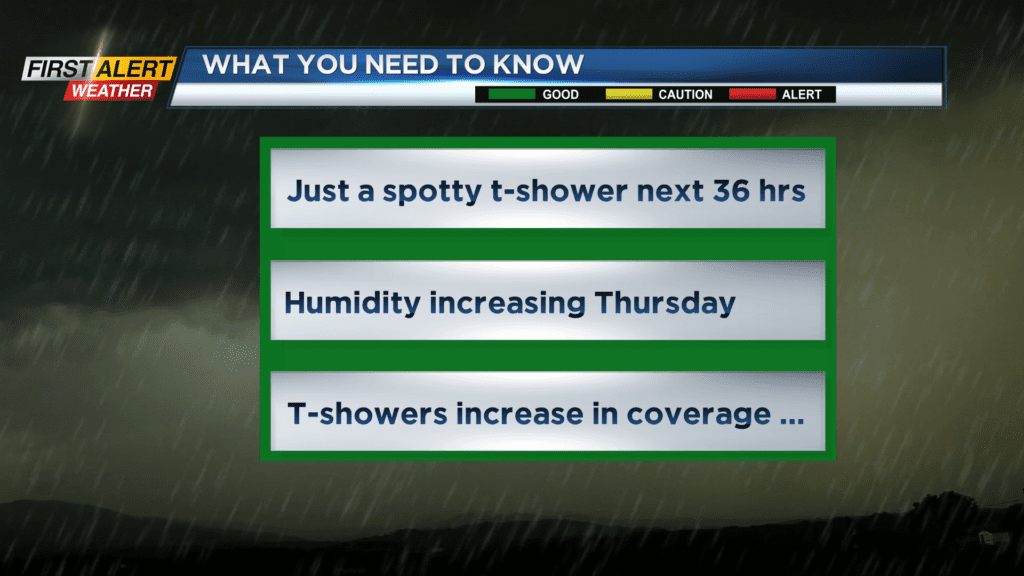
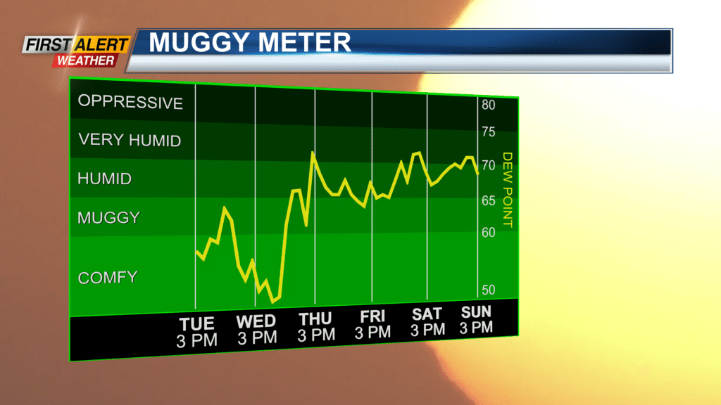
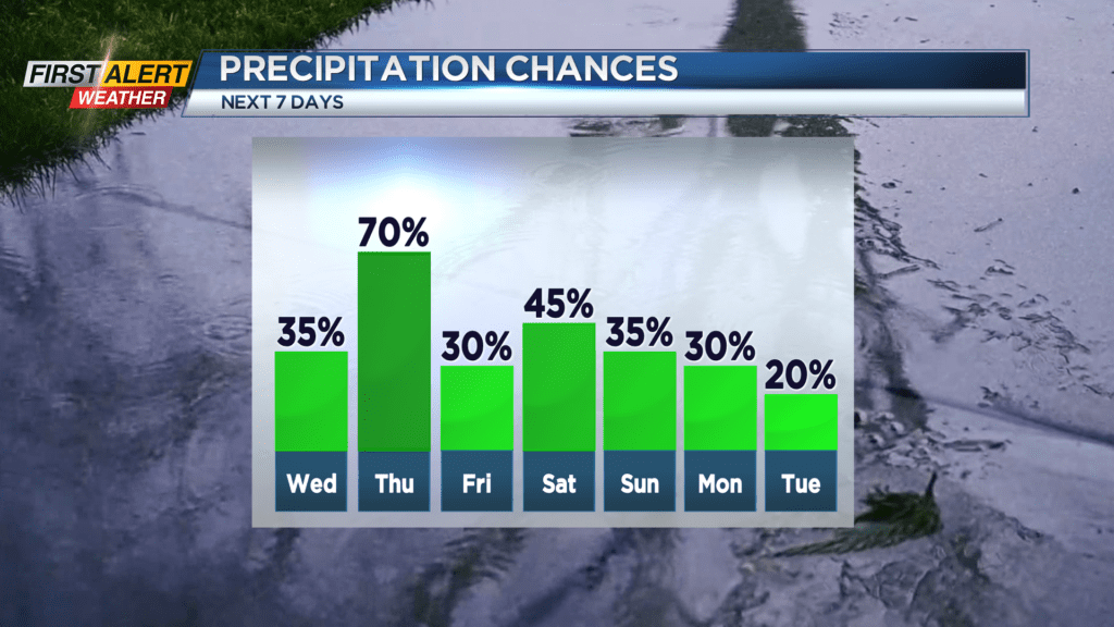
ROCHESTER, N.Y. – Most folks would describe Tuesday as comfortable for Western New York. The ingredients for this have been lower temperatures, and lower amounts of humidity. This is likely to change in the coming days as the muggy conditions will return by the middle of the week. As that happens, the risk of showers and thunderstorms will go up slowly over the next 24 hours, but the probability of rain goes up significantly by Thursday and Thursday night. During this time, a cold front is likely to stall over Western New York and this front will be focal point for this summer convection.
Tuesday night look for partly cloudy skies and there is the chance of a spotty thundershowers west of Rochester. The temperature will fall into the lower to middle 60s. Wednesday will feature partial sunshine with another spotty thundershower possible, however, most of the time should be dry. The high temperature will be within a few degrees of 80. Thursday and Thursday evening it is recommended that you keep the umbrella handy. With lots of humidity it will feel tropical outside. It does not appear to be severe weather, but look for occasional showers and thunderstorms. The high temperature will be in the middle 80s.
Stay tuned to News 10NBC First Alert weather for updates on the forecast.