First Alert Forecast: Nice weather for the rest of the weekend, then a Yellow Alert for Monday
[anvplayer video=”5187745″ station=”998131″]
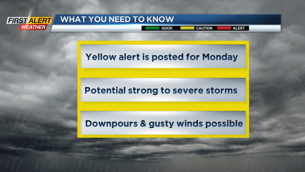
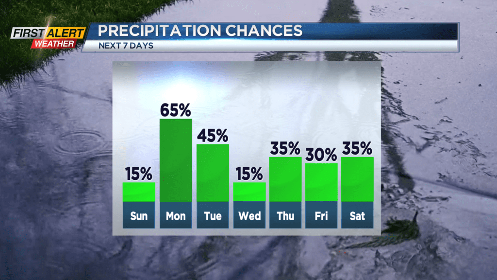
ROCHESTER, N.Y. – Low humidity, a light breeze and comfortable temperatures have made for a pleasant Saturday. A large high-pressure system will slowly move across the Great Lakes and bring nearly the same weather for the next 24 hours. This should make for a nice end to the weekend. However, a warm front and low-pressure system will approach Western New York Sunday night and Monday. This will likely bring a surge of humidity and unstable air for the start of the week with occasional showers and thunderstorms. There is the potential for strong to severe storms Monday and Monday night. As a result, the News 10NBC First Alert meteorologists will continue a yellow alert for Monday.
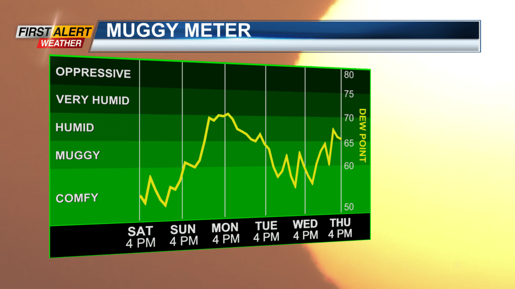
Sunday night, look for patchy clouds to give way to clearing skies during the overnight. It will be a comfortable night with the low temperature near 57 degrees. Sunday will bring mostly sunny skies and rain free day is expected. If you are going to the Bills Camp at the St. John Fisher University (11:45 AM start time) you will find increasing amounts of humidity with the temperature rising into the lower 80s. Then there is an increasing chance of showers and thunderstorms for Sunday night with the low in the upper 60s. Monday will sneak in a few breaks of sun, but also an occasional shower and thunderstorm. Some of these storms will have the potential to be strong to maybe severe during the afternoon and evening hours on Monday. It will feel tropical with lots of humidity and a high temperature in the middle 80s.
Stay tuned to News 10NBC First Alert Weather for updates on the forecast.