First Alert Forecast: No sign of spring for this first full week of March
[anvplayer video=”5166043″ station=”998131″]
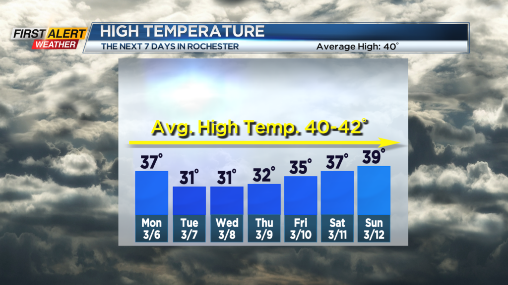
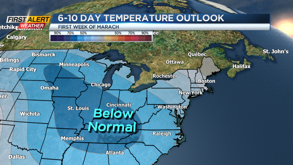
ROCHESTER, N.Y. – Relatively calm weather will remain in place over the next 24 hours, but a weak area of low pressure will pass just south of the Pennsylvania border tomorrow evening. This will produce a small accumulation of snow south of Rochester heading into Tuesday morning. If you are looking for early signs of spring, you will not find it this week. Below normal temperatures are expected though the next seven to 10 days.
Sunday night, look for mainly cloudy skies, but it will be dry with the low temperature in the upper 20s. Monday will be another gray day with a few rain or wet snow showers possible by the afternoon. The high temperature is expected to be in the upper 30s. Monday night will likely bring more persistent light snow. Any accumulation should be less than an inch in the Rochester area, but in the higher elevations, mainly south of Routes 5 and 20, there could be a several inches of accumulation by Tuesday morning.
Get used to the chilly weather as an unseasonably cold weather pattern will likely be with us through the middle of the month. Snow flurries and occasional snow showers are expected for Tuesday and Wednesday with daytime temperatures remaining mainly in the 30s right into next weekend.
Stay tuned to News 10NBC Frist Alert weather for updates on the forecast.