First Alert Forecast: Pleasant end to the weekend
[anvplayer video=”5141995″ station=”998131″]
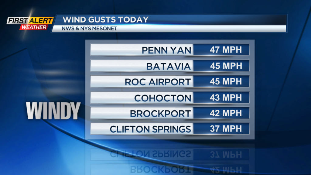
ROCHESTER, N.Y. – A cold front moved across Western New York today. That produced some gusty winds with many areas seeing speeds over 40 mph. However, high pressure will build into the area for tonight and Sunday with a return to less wind and more sunshine to finish the weekend. The recommendation is to enjoy the nice October weather tomorrow as nasty conditions will return later in the week.
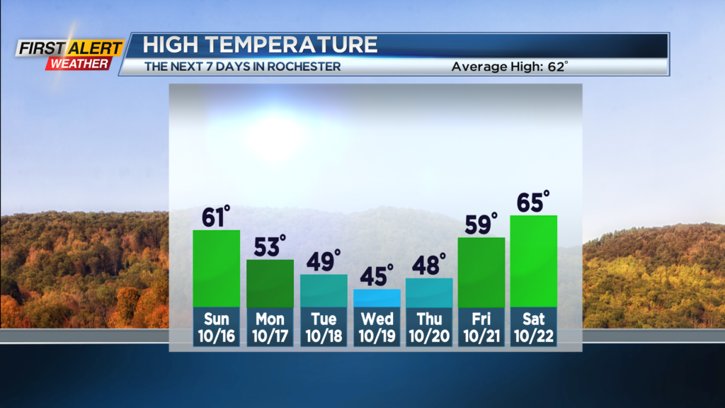
Tonight will be clear at times. The winds will diminish with the temperature falling to within a few degrees of 40. Ample sunshine is returning for Sunday and with much less wind expected. This should make for a pleasant finish to the weekend. The high temperature on Sunday will be near 60 degrees.
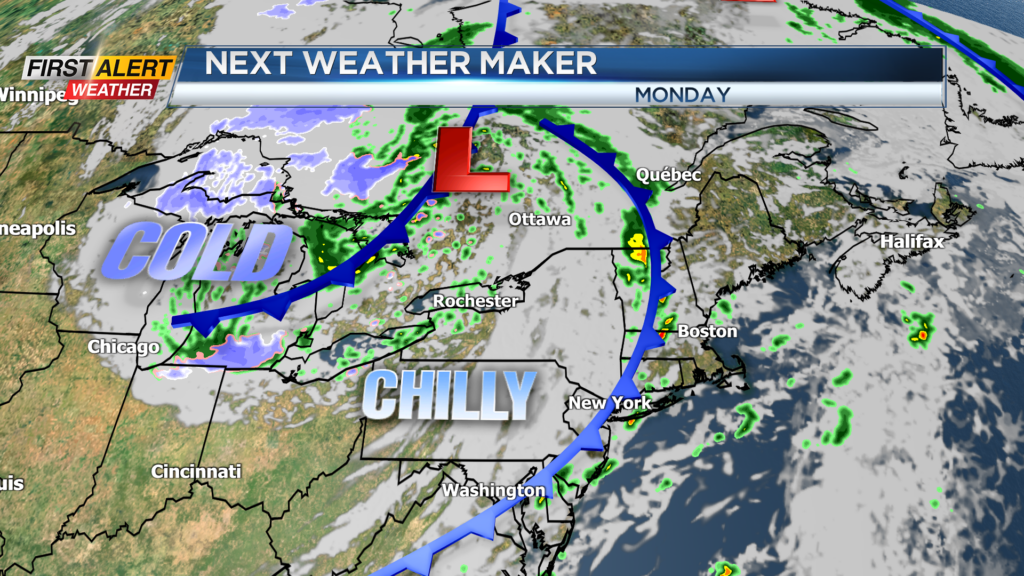
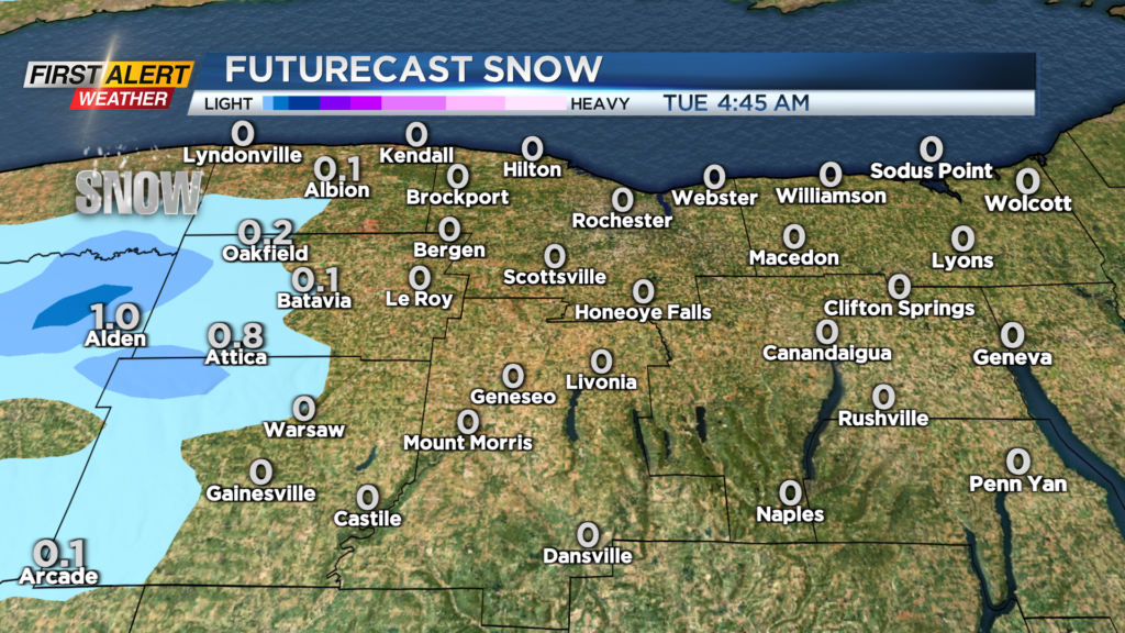
Monday another cold front and a more significant trough of low pressure will cross into Western New York. This will bring progressively colder air with an extended period of unseasonably cold temperatures for much of the upcoming week. The temperature will fall through the 50s, into the 40s, with Lake Erie rain showers developing. Most of the rain showers should be located west of Rochester. The coldest weather of the season arrives for Tuesday, Wednesday and Thursday with readings in the 40s during the day and into the 30s at night. This should be marginally cold enough for some mixed precipitation with a combination of rain, wet snow and possible some ice pellets mixing in. No accumulation is expected in Rochester, but the higher elevations southwest of the area could see a little coating of wet snow. Conditions will moderate with milder weather by the end of the week.
Stay tuned to News 10 NBC First Alert for updates on the forecast.