First Alert Forecast: Potential for poor drainage flooding
[anvplayer video=”5174710″ station=”998131″]
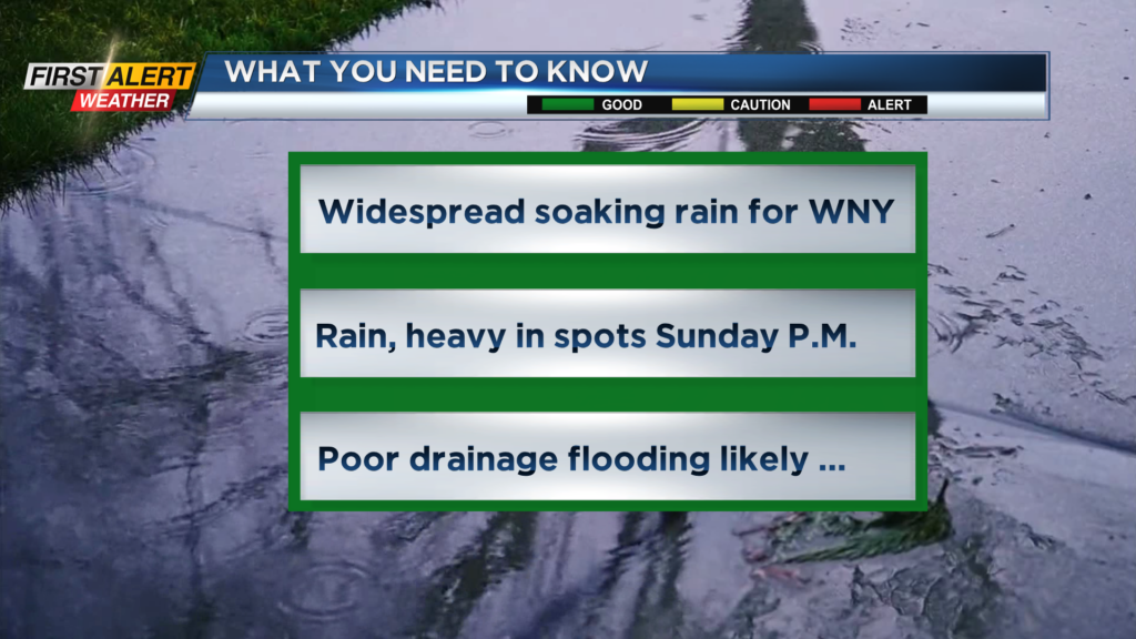
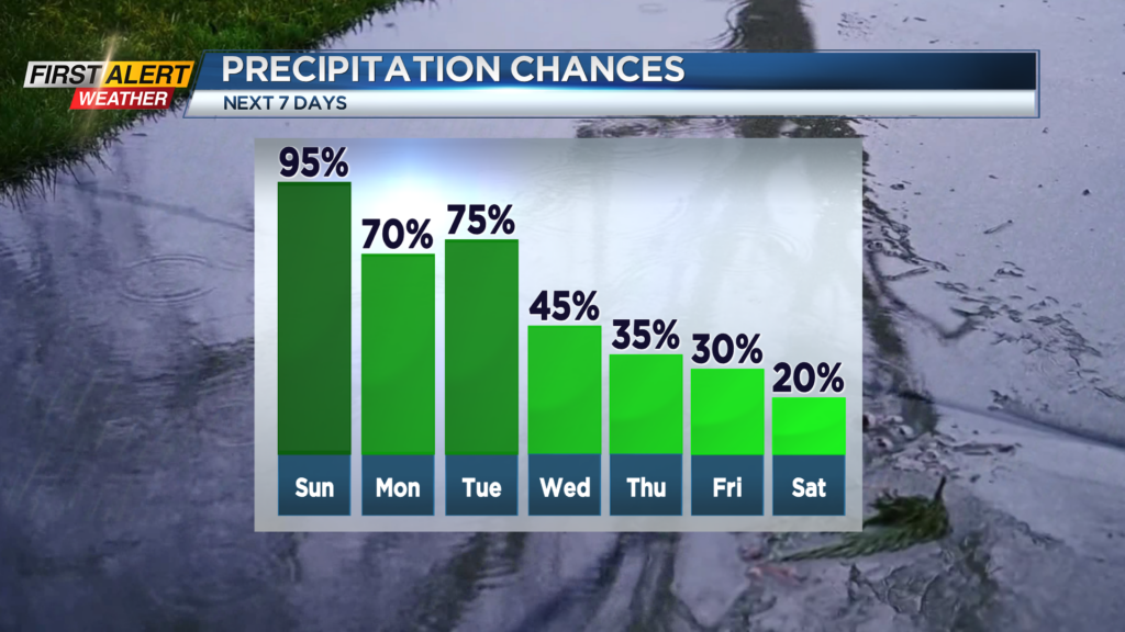
ROCHESTER, N.Y. – A strengthening low-pressure system is anchored across the great lakes today and will move very slowly east through the middle of the week. A surge of rain develops from south to north during the next 24 hours and will likely bring a soaking rain to all Western New York. No major flooding is expected, but the News 10 First Alert meteorologists do look for ponding on roadways with localized poor drainage flooding, especially east of Rochester for Sunday afternoon. Unfortunately, since this is a slow-moving weather system, significantly drier weather will not return until the end of the week.
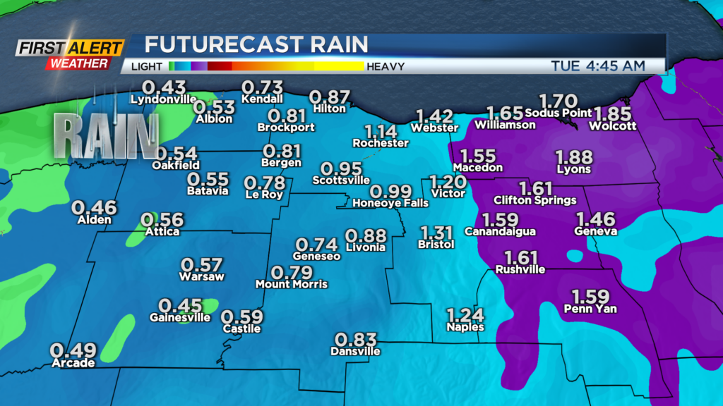
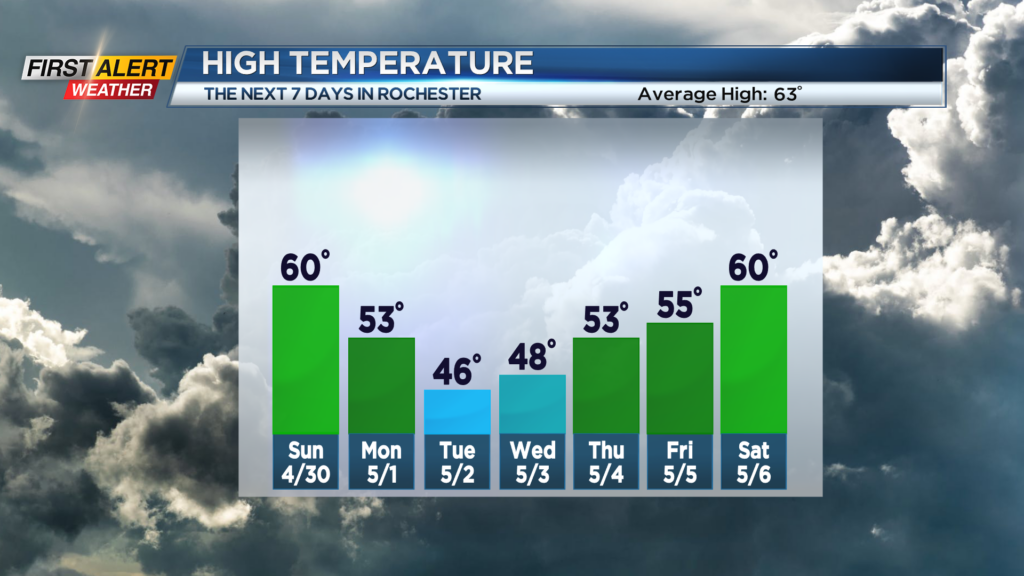
Tonight, sprinkles of rain will develop into more persistent showers later tonight. The low temperature will be within a few degrees of 50. Sunday look for light rain early to increase to a more steady rain. In addition, it could be heavy at times. Rainfall amounts should be an inch or less west of Genesee Valley but could exceed 1.5 inches east of Genesee Valley – especially over the Finger Lakes. Rivers and creeks will rise quickly, but at this time no major flooding is expected. The high temperature will be near 60 degrees early on Sunday with the temperature falling later into the afternoon. Monday the rain will taper to just passing showers and with a gusty wind the temperature will be in the lower 50s. Tuesday more showers are likely, and it will be turning chilly for the month of May with the temperature struggling to get out of the 40s. It may be cold enough to mix in a few wet flakes in the hills south of Rochester.
Stay tuned to News 10NBC First Alert weather for updates on the forecast.