First Alert Forecast: Rain is ending after one of the wettest Julys on record
[anvplayer video=”5186989″ station=”998131″]
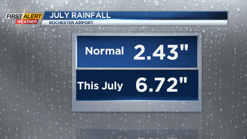
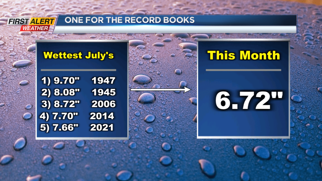
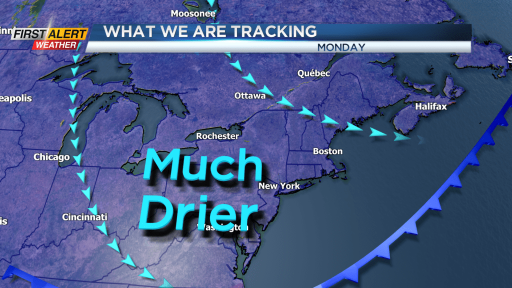
ROCHESTER, N.Y. – Seven out of the last ten days has produced measurable rainfall at the Rochester Airport. In fact, it has been one the wettest July’s in recent memory! This entire month has measured 6.72 inches of rainfall. That is 189 percent of historical normal precipitation (3.56 inches) and places this July at sixth on the list of wettest July’s on record. This rainfall data is measured through 140 years of record keeping. Fortunately, the dry weather is making a return and the News 10NBC First Alert meteorologists expect several days of dry comfortable weather for Western New York.
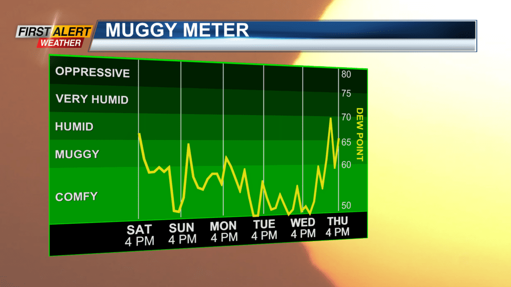
Saturday night, look for just a spotty shower and skies will become partly cloudy. The humidity will continue to fall with the low near 58 degrees. Sunday will bring a beautiful day with mostly sunny skies. It will be noticeably cooler and drier with the high temperature in the middle 70s. Monday will feature partial sunshine with just the chance of a spotty shower or thundershower. Again, we will enjoy lower humidity and cooler temperatures. The mercury will rise only into the mid-70s. The first sign of any mid-summer heat is not until Thursday.
Stay tuned to News 10NBC First Alert weather for updates on the forecast.