First Alert Forecast: Records are made to be broken
[anvplayer video=”5146458″ station=”998131″]
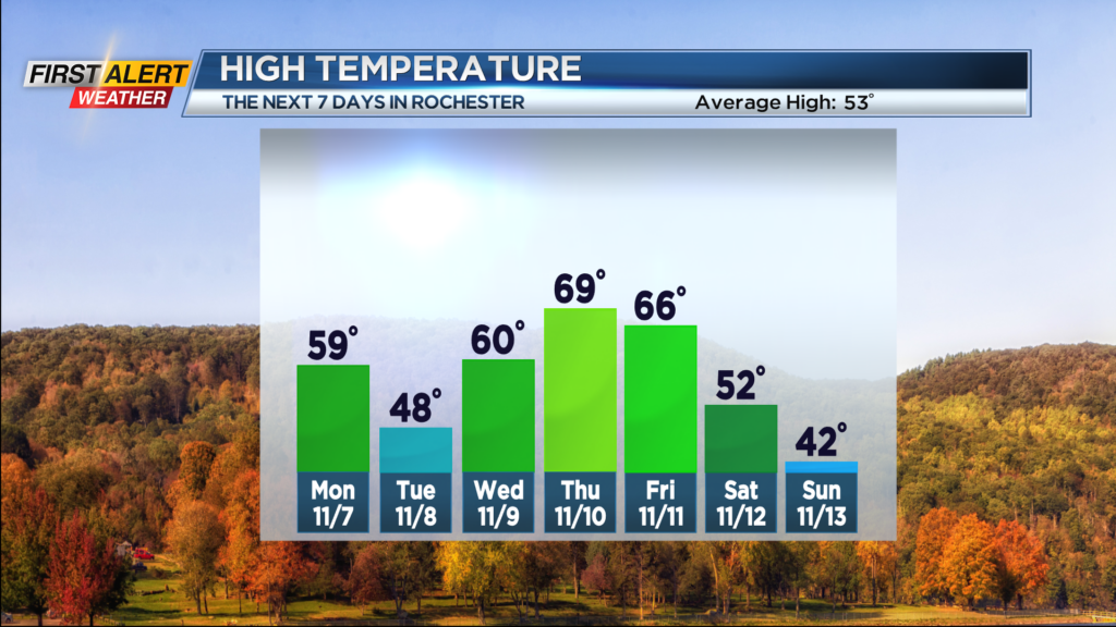
ROCHESTER, N.Y. – Today makes two days in a row with the temperature reaching record territory for Rochester. Early this morning the Rochester Airport measured 72 degrees, which tied the record last set in 2015 and also a milestone reached during several previous years. This first week of November has produced an extraordinary run of unseasonably warm weather, especially when you compare it to the normal high temperature in the lower 50s. However, several cold fronts will be bringing progressively colder air during the next 48 hours.
Tonight will bring patchy clouds with chance of a spotty shower. The low temperature will fall to near 50 degrees. Monday expect Western New York to be back in the sunshine, but it will be breezy and noticeably cooler. The high temperature is expected to be in the upper 50s. The sunshine continues into Tuesday, but the temperature will continue to fall with the mercury only getting into the upper 40s. So it will be a dry, but very brisk for Election Day.
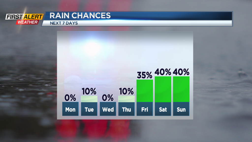
It appears the warmer weather will rally by the middle of the week. Wednesday will feature more sunshine and the temperature will push near 60 degrees. Thursday will bring more sunshine and a return to even warmer weather. The high temperature will once again reach near 70 degrees. Enjoy the warmer weather because it will turn sharply colder with mixed lake effect precipitation likely by the end of the upcoming weekend.
Stay tuned for updates on the News 10NBC weather forecast.