First Alert Forecast: Significant winter of any kind not likely for most of this week
[anvplayer video=”5161110″ station=”998131″]
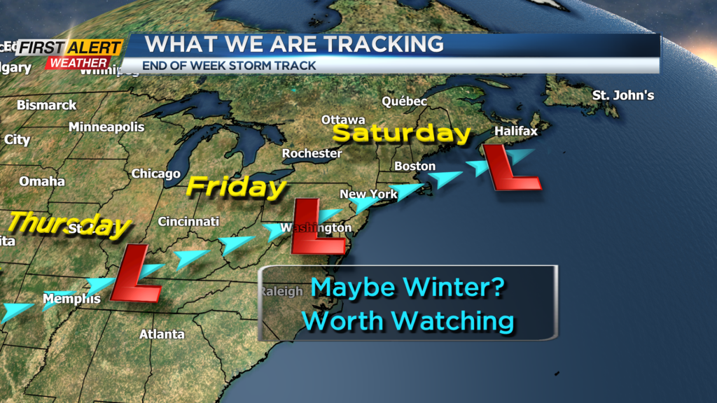
ROCHESTER, N.Y. – Once again “old man winter” takes a vacation for a lot of the upcoming week. Here in Western New York above normal temperatures are expected for five of the next seven days. As a result, most of the time, precipitation will be in the form of rain or just wet flurries. It is still very questionable, but in the longer range the first opportunity for any real winter conditions will not be until next weekend.
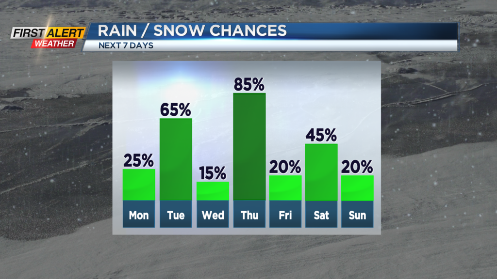
Tonight, look for spotty rain showers mixing with wet snow showers. There is the small chance of coating of snow in the higher elevations south of Rochester by morning. The low temperature near 32 degrees. Monday will bring more clouds with the chance of snow flurries for the morning. Then skies may brighten later in the afternoon. The temperature in the low to middle 30s and the mercury may slowly fall during the afternoon. Tuesday it is back to the breezy and milder weather. There is the chance of a few rain showers for the afternoon. Not your typical February weather with the high temperature in the upper 40s. Wednesday will feature partial sunshine and a temperature in the lower 40s.
Rain will likely arrive on Thursday with another unseasonably mild day. The high temperature again in the upper 40s. We should slowly dry things out for Friday and then snow showers and colder weather is likely for Saturday.
Stay tuned to News 10NBC First Alert weather for any updates on the forecast.